Downloads
Overview

These data layers are used to index the 2013/2014 Aerial Imagery tiles and MrSID mosaics distributed by MassGIS.
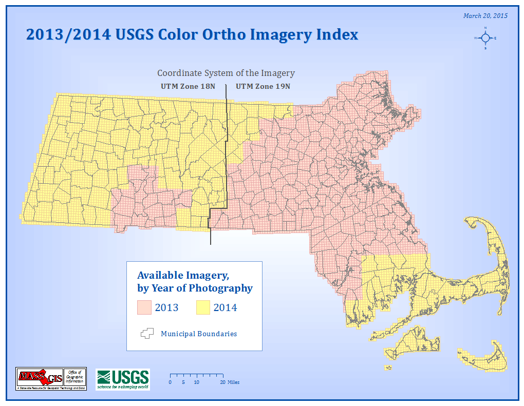
The layer named COQ2013INDEX_POLY is an index for the original GeoTiff images and the MassGIS-produced JPEG 2000 versions. It stores the Web links for the JPEG 2000 free downloads. Each tile measures 1,500m x 1,500m. Click on the top image at right to view a larger index map and also see the PDF version of the Index Map
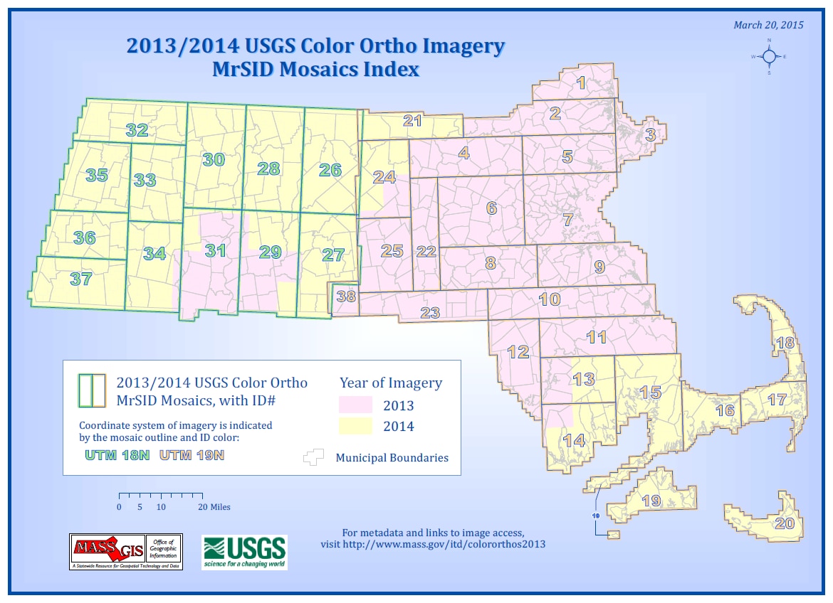
The layer named COQ2013MOSAICS30CM_POLY is used to index the MrSID mosaic images created from the original GeoTiffs at 30:1 compression ratio. Click on the image at the lower right to view a larger index map and also see the PDF Index Map for details.
Production

The GeoTiff/JPEG 2000 index polygons were delivered to MassGIS with the imagery from USGS, one for each of the delivery areas (Boston, Worcester and Springfield for 2013, and UTM18 and UTM19 for 2014). The Boston, Worcester and UTM19 polygons were referenced to the UTM Zone 19N coordinate system. The Springfield and UTM18 polygons were referenced to the UTM Zone 18N coordinate system. MassGIS projected each layer to the NAD1983 Mass. State Plane Mainland Meters coordinate system and merged them into this one feature class and added some attribute fields. Note that MassGIS did not project the imagery: all imagery was kept in the original UTM projections as delivered by the USGS.
To create the MrSID mosaic index, MassGIS added the MOSAIC field to the original tile index and dissolved the layer on that field using ArcGIS 10.2. The MrSID mosaic index is referenced to the NAD1983 Mass. State Plane Mainland Meters coordinate system.
Attributes
The COQ2013INDEX_POLY polygon attribute table contains the following fields:
| Attribute | Description |
|---|---|
| TILENAME | Unique 11-character ID for each 1,500m x 1,500m tile. Image names that begin with "18" are referenced to the UTM NAD 1983 Zone 18N coordinate system. Image names that begin with "19" are referenced to the UTM NAD 1983 Zone 19N coordinate system. |
| DEL_AREA | Name of USGS project delivery area. For 2013 imagery the codes are BOS=Boston, SPR=Springfield and WORC=Worcester. For 2014 imagery the codes are UTM18 and UTM19. |
| URL | Web link for downloading JPEG 2000 tiles |
| MOSAIC | Name (number) of the MrSID mosaic of which the tile's image is a part. |
| IMG_YEAR | The year in which the imagery was captured (2013 or 2014). |
The COQ2013MOSAICS30CM_POLY polygon attribute table contains the following fields:
| Attribute | Description |
|---|---|
| MOSAIC | Name (number) of the MrSID mosaic |
| URLS | Web link for downloading MrSID mosaic |
| YEAR | The year in which the imagery was captured (2013 or 2014). Some mosaics contain tiles from both years and are coded 2013-2014 in this field. |
| COORD_SYS | The coordinate system to which the imagery is referenced: UTM18 (UTM NAD 1983 Zone 18N) and UTM19 (UTM NAD 1983 Zone 19N). |
Maintenance
These datalayers are maintained by MassGIS. Tiles covering Cape Cod were added in March 2015, at which time the 2013-2014 imagery was available statewide.