Downloads
Overview

The Areas of Critical Environmental Concern (ACEC) datalayers provide digital polygon and line boundaries for areas that have been designated ACECs by the Secretary of Energy and Environmental Affairs (EEA). ACECs are places in Massachusetts that receive special recognition because of the quality, uniqueness and significance of their natural and cultural resources. These areas are identified and nominated at the community level and are reviewed and designated by the state’s EEA Secretary. ACEC designation creates a framework for local and regional stewardship of these critical resource areas and ecosystems. ACEC designation also requires stricter environmental review of certain kinds of proposed development under state jurisdiction within the ACEC boundaries.
The ACEC Program is administered by the Department of Conservation and Recreation (DCR) on behalf of the Secretary of Environmental Affairs. The Massachusetts Office of Coastal Zone Management (CZM) Office administered the original Coastal ACEC Program from 1978 to 1993, and continues to play a key role in managing coastal ACECs. Procedures for ACEC designation and the general policies governing the effects of designation are contained in the ACEC regulations (301 CMR 12.00). For more information about the ACEC datalayer or about the effects of ACEC designation, contact the ACEC Program at (617) 626-1394 or see the ACEC website.
The ACEC datalayers have been compiled by CZM and DCR and include both coastal and inland areas. New ACEC polygons (and corresponding boundary lines) are added periodically, as new ACEC nominations are reviewed and designated on an ongoing basis.
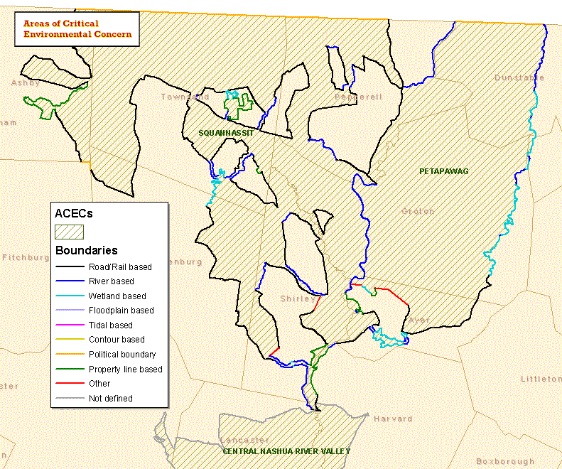
As of April, 2009 there are coded boundary arcs available for 10 of the 30 ACECs, part of an ongoing datalayer update program begun in 2003. These coded boundaries indicate what features are used for various ACEC boundary line segments, such as roads, town lines, or wetlands resource areas. The other 20 ACECs do not yet have individually coded arcs, but are shown in the line layer with arcs coded ‘NOT DEFINED.’ Boundaries are also periodically clarified for better agreement with new GIS datalayers – designated boundaries do not change, but the accuracy with which they are described and mapped is improved. Discrepancies are more obvious with older boundaries, and at this time the 2008 Three Mile River Watershed ACEC boundary does not align with the adjacent 1990 Hockomock Swamp and 1991 Canoe River Aquifer ACECs which need to be clarified.
This datalayer is intended to be used for planning purposes only and with the written boundary descriptions contained in each ACEC designation document. The mapped boundary is not to be used by itself for definitive ACEC boundary delineation or regulatory interpretation. For review of site-specific projects within the ACEC boundary, determinations may need to be made in the field or in consultation with ACEC Program staff.
These datalayers are stored in ArcSDE and distributed as ACECS_POLY and ACECS_ARC.
Production
Polygons are compiled from 1:25,000 USGS quad sheets, 1:5,000 ortho imagery, or other MassGIS datalayers and digitized.
Boundaries were snapped to roads, political boundaries, water features, etc., depending on the feature defining the edge. An effort was made to use the best available data at the time of editing. Where the source data are at a lower resolution than the USGS quad, data were changed to provide "relative visual accuracy.” Where the source data are at a higher resolution than the USGS quad, the higher resolution data were usually kept.
Attributes
Items in the attribute table of the ACECS_POLY polygon layer include:
| Field name | Description |
|---|---|
| ACECID | Unique identifier of each area |
| NAME | The name of the area |
| DES_DATE | The date the Secretary signed the designation |
| SECRETARY | The name of the Secretary who signed the designation |
| ADMIN_BY | Agency responsible for the ACEC |
| REGION | COASTAL or INLAND |
| POLY_ACRES | Acreage of each polygon |
| ACEC_ACRES | Total acreage of each ACEC |
Items in the attribute table of the ACECS_ARC line layer include:
| Field name | Description |
|---|---|
| BND_TYPE | The feature that defines the boundary (see codes below) |
| SOURCE | The GIS layer that was used to digitize the line (see codes below) |
| UPDATE_ | The date the line was last updated |
| FROM_ACEC | The ACEC the line is part of (in cases where two ACECs share a boundary, the line will list only one of the ACECs) |
| LEGEND_GRP | A code used for symbolizing the lines (a grouped version of BND_TYPE) |
Codes for BND_TYPE:
| Field name | Description |
|---|---|
| 10 FT CONTOUR | 10 ft contour |
| 10 FT CONTOUR + 100 FT | A 100-ft buffer of the 10 ft contour line |
| 100 FT WETLAND BUFFER ZONE | A 100-ft buffer of wetlands resource area (as defined by Wetlands Protection Act Regulations 310 CMR 10) |
| 200 FT RIVERFRONT AREA | A 200-ft-wide riverfront corridor (a resource area defined by Wetlands Protection Act Regulations 310 CMR 10) |
| 6 FT DEPTH CURVE | 6 ft depth curve |
| BEACH | State Designated Barrier Beach |
| CONNECTING LINE | Connects two features that do not meet |
| CULVERT | Culvert |
| DAM | Dam |
| DREDGE CHANNEL | Dredge Channel |
| FLOODPLAIN | FEMA Q3 flood zone boundary |
| MEAN HIGH WATER | Mean high water |
| MEAN LOW WATER | Mean low water |
| MEAN SEA LEVEL | Mean sea level |
| NOT DEFINED | Used with ACECs that have not had their boundary line segments individually coded yet |
| POWERLINE | Right-of-way of a utility easement |
| PUBLIC PROPERTY LINE | Property line of publicly-owned land |
| RAILROAD RIGHT-OF-WAY | Right-of-way of a current or former railroad |
| RIVER CENTERLINE | River centerline |
| ROAD | Includes entire right-of way of road unless otherwise stated in ACEC designation |
| STATE LINE | State line |
| TOWN LINE | Town line |
| WETLAND | Wetlands resource area (as defined by Wetlands Protection Act Regulations 310 CMR 10) |
Codes for SOURCE:
| Field name | Description |
|---|---|
| Connects Two Features | A straight line connecting two features - used in areas where two GIS sources don't quite meet |
| DEP 12 k Wetlands Datalayer | DEP 12k Wetland polygons and arcs |
| DEP 12 k Wetlands Data/5k Ortho | DEP 12k Wetland Hydrologic Connections; in wetland areas where 12k linework does not follow the stream, sections of stream were traced over MassGIS 5k Color Ortho |
| EOT-OTP Roads Datalayer | Centerlines were used but ACEC boundary definition often includes entire road right-of-way |
| MassGIS 5k B/W Ortho | Line traced using black-and-white orthophoto |
| MassGIS 5k Color Ortho | Line traced using color orthophoto |
| MassGIS 5k Road Centerlines | Centerlines were used but ACEC boundary definition often includes entire road right-of-way |
| MassGIS 5k Wetlands | Wetland polygons and arcs |
| MassGIS 5k Wetlands Arcs | Wetland arcs only |
| MassGIS FEMA Q3 Flood Data | FEMA Q3 flood zone boundary |
| MassGIS Hydro Centerline Route | MassGIS Hydro Centerline Route |
| MassGIS Level 2 Parcel Data | MassGIS Level 2 Parcel Data |
| MassGIS MA Towns Datalayer | MassGIS MA Towns Datalayer |
| MassGIS Protected Open Space | Protected land boundary line |
| MassGIS Survey Towns Datalayer | MassGIS Survey Towns Datalayer |
| MassGIS Trains Datalayer | MassGIS Trains Datalayer |
| NOT DEFINED | Used with ACECs that have not had their boundary line segments individually coded yet |
| State Designated Barrier Beach | State Designated Barrier Beach |
| USFWS Property Data | Federal data that was not yet available in OpenSpace |
| USGS 25k Hydrography | Hydro lines and polygons |
| USGS Topo Quad | Line traced from USGS Quad images |
| USGS Topo Quad and 5k BW Ortho | Traced using USGS Quad and Orthophoto images |
| USGS Topo Quad and bearing | Line drawn at a particular bearing using USGS Quad for placement |
Maintenance
DCR continues to add lines and polygons as new ACECs are designated. The most recent were the Three Mile River Watershed ACEC in August 2008 and the Upper Housatonic River ACEC in March, 2009. Adjustments to existing data are periodically made to improve the accuracy of the data. In March 2007 a few ACEC names were modified, and all names were converted to title case format.