Downloads
Overview
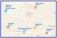
Pool types include swimming, wading, diving and spray deck. The layer was developed by the DCR GIS Program. MassGIS updated the data layer based on DCR pool listings as of January 27, 2025.
The layer is stored in ArcSDE and distributed as DCRPOOLS_PT.
Production
A list of pools was obtained from the Division of State Parks and Recreation. Each pool was on-screen digitized using a variety of sources (address information from the DCR Pool locations, ortho imagery, Pictometry, etc.). Each pool type and status was verified with ortho imagery and Pictometry and, if necessary, by DCR field staff. Lifeguard status was verified via the Division of State Parks and Recreation. Universal accessibility was verified by the DCR Universal Access Program and DCR field staff. Physical addresses and phone numbers were imported from the DCR Pools website (above) and verified or refined to the greatest extent possible. Each pool name was researched in the Massachusetts Acts and Resolves Session Laws from 1692 to 2010. The applicable legislation was recorded in the LEGISLATION field. Finally, the REGION and DISTRICT and FOT (Field Operation Team) fields were populated via a spatial join between this datalayer and an in-house DCR regions and districts datalayer.
Attributes
The DCR Pools datalayer's point attribute table has the following fields:
| Field | Description |
|---|---|
| NAME | Official name of pool |
| TYPE | Type of pool (types may be combined): Swimming - Water depth of at least two feet. |
| STATUS | Pool status ("Open" or "Closed" (temporary)) |
| LIFEGUARD | Level of lifeguard staffing ("YES" or "NO") |
| ACCESSIBLE | Level of universal accessibility ("YES" or "NO") |
| ADDRESS | Physical address of pool |
| TOWN | Town where pool is located |
| PHONE | Phone number of pool or facility where pool is located |
| REGION | DCR region where pool is located |
| DISTRICT | DCR district where pool is located |
| LABEL | Abbreviated pool name, appropriate for map labels |
| LEGISLATION | Legislation designating official pool name |
| COMMENTS | Additional information about pool |
| FOT | DCR FOT (Field Operation Team) responsible for pool |
| POOL_ID | Unique, static ID for each pool for querying purposes |
Maintenance
DCR maintains this datalayer and will provide updates to MassGIS.
| Last updated: | January 28, 2025 |
|---|