Downloads
Overview
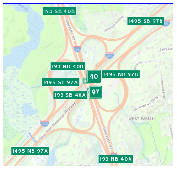
These two statewide point feature classes represent the locations of exits and interchanges on limited access highways:
- Exits (HWYEXITS_PT) - One point at each off-ramp, located approximately at the "gore point" (the triangular area of space between the through travel lanes and the off-ramp) or where the exit lane begins. Includes the letter ('A' and 'B', e.g.) designations for north/south, east/west.
- Interchanges (HWYINTERCHANGES_PT) - One point for each junction where there is a unique exit number. The points are located at the approximate midpoint of the interchange and represent all the ramps with that exit number. In most cases these include only the numeric portion of the exit number.
MassGIS downloaded the data from the Massachusetts Department of Transportation's GeoDOT portal (Exits and Interchanges) and adjusted the locations of some of the points using the 2021 aerial imagery basemap and Google Street View.
Attributes
The HWYEXITS_PT point attribute table contains the following fields:
| Filed Name | Description |
|---|---|
| EXIT_NUM | The exit number, including letter designations |
| ROUTE_ID | Route administrative type with number and direction |
| EXIT_KEY | Route administrative type with number and direction, and exit number |
| LEGACYEXIT | Legacy exit number prior to the 2020-2021 renumbering project. |
The HWYINTERCHANGES_PT point attribute table contains the following fields:
| Field Name | Description |
|---|---|
| EXIT_NUM | The exit number, in most cases only the numeric portion. Letter designations are included if the legacy exits are different. |
| ROUTE_NUM | The number of the route associated with the interchange |
| CORRIDOR | The route number with its administrative type prefix (I = Interstate; US = U.S. Route; SR = State Route) |
| JUNCTION | MassGIS added this field, which describes the junction of the road or route that crosses the limited access highway. Based on PDFs at the Statewide Exit Renumbering Project Details page. |
| LEGACYEXIT | Legacy exit number prior to the 2020-2021 renumbering project. |
Maintenance
MassDOT maintains the original datasets. MassGIS will update these layers as needed. With the March 2023 update these layers replace the Highway Exits (EXITS_PT) layer.
MassGIS removed two records from the attribute table with zero geometry in April 2025; these were duplicates of records with valid geometry.
| Last updated: | April 28, 2025 |
|---|