Downloads
Overview

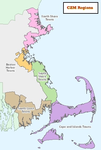
The boundaries do not represent the true interior or exterior boundary of the coastal zone that is delineated in the Massachusetts Coastal Zone layer. Instead, this layer shows the towns that are either fully or partially included in the MA Coastal Zone as outlined in CZM's program that is reviewed and authorized by NOAA. See this CZM webpage for more details.
The ArcSDE layers and Data Viewer shapefiles are named REGCZM_POLY.
This layer was updated in August 2021 to be based on the Survey Town Boundaries (previously based on USGS-based town boundaries).
Attributes
The polygon attribute table contains the following items:
| Item | Width/Type | Description |
|---|---|---|
| REGION | 50 / C | Region Name |
| URL | 100 / C | Region Web Page |
Maintenance
CZM will provide any updates to MassGIS.
Updated in April 2022 to reflect recent edits to the Municipalities layers.