Downloads
The .zip includes ESRI Shapefiles (arc and polygon), ArcMap layer files (.lyr) (for ArcMap 10 and 9.0*)
Note: * The data sources in the LYR for Arc 9 will need to be reset)
Overview
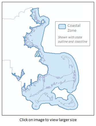
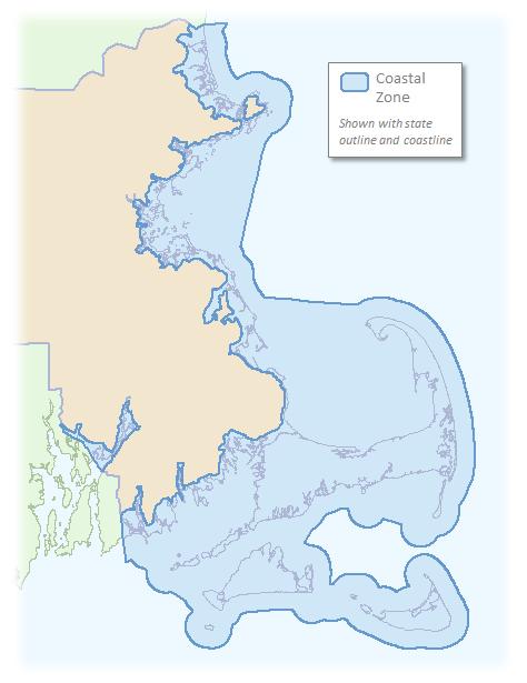
The Massachusetts Coastal Zone data layer was compiled by the Massachusetts Office of Coastal Zone Management (CZM) to represent the Massachusetts coastal zone as defined in the October 2011 Massachusetts Office of Coastal Zone Management Policy Guide ("Policy Guide"). Appendix 2 of the Policy Guide contains the most recent description of the official Massachusetts coastal zone and should be used in connection with the following two sources depicting maps of the boundary: (1) the CZM Coastal Atlas (Volume II of the 1977 Massachusetts Coastal Zone Management Program and Draft Environmental Impact Statement) and (2) this data layer developed by CZM to depict the coastal zone in digital map format. This boundary was created per the Federal Coastal Zone Management Act (CZMA) of 1972 (Public Law 92-583, 16 U.S.C. 1451-1456). The boundary description is the specification of the major roads, rail lines, other visible rights-of-way, or coordinates marking the inland boundary of the coastal zone. The actual boundary is 100 feet inland of the landward side of the described line, with the exception of municipal boundaries, where the municipal boundary is the limit of the boundary description. This dataset represents the actual boundary.
As described in Appendix 2 of the Policy Guide, the official Massachusetts coastal zone includes the lands and waters within an area defined by the seaward limit of the state's territorial sea, extending from the Massachusetts-New Hampshire border south to the Massachusetts-Rhode Island border, and landward to 100 feet inland of specified major roads, rail lines, other visible rights-of-way, or, in the absence of these, at specified coordinates. The coastal zone includes all of Cape Cod, Nantucket, Martha's Vineyard, and the Elizabeth Islands. The coastal zone includes all islands, transitional and intertidal areas, coastal wetlands, and beaches within the Commonwealth. In isolated instances where the boundary line might exclude coastal resource area(s), these resources are included in the coastal zone although the written description follows the boundary line. Tidal rivers and adjacent uplands are included, at a minimum, to the extent of vegetation affected by measurably saline water. Anadromous fish runs are included, as well as their floodplains, to the freshwater breeding area, if such area is within a coastal town. Land owned or controlled by the federal government is excluded by law from the coastal zone.
This layer is available as a polygon, named CSTZONE_POLY, or line, named CSTZONE_ARC.
Production
Coastal Zone Inshore Boundary: The coastal zone inshore boundary was created by following the verbal boundary description given in Appendix 2 of the October 2011 Massachusetts Office of Coastal Zone Management Policy Guide. Data sources used were MassDOT's "Massachusetts Department of Transportation (MassDOT) Roads - October 2009 " data layer for streets and highways, the Central Transportation Planning Staff's "Trains - April 2008 " data layer for railroad corridors, and MassGIS's "Municipalities - June 2004" for inland municipal boundaries. In the absence of major roads, railroad corridors, and other visible rights-of-way, coordinates were specified in Appendix 2 to mark the inland boundary of the coastal zone and these coordinates were mapped in ArcGIS 10. Please note: Per Appendix 2, "the actual boundary is 100 feet inland of the landward side of this line, with the exception of municipal boundaries, where the municipal boundary is the limit of the line." Since the landward side of the road could not be determined from the MassDOT roads layer, a 100-foot landward buffer was created from the depicted road center line; when two lanes were shown on the MassDOT layer (e.g., for a divided highway), the landward-most lane was used to create the buffer. Similarly, since the landward side of the railroad corridor could not be determined from the Central Transportation Planning Staff data layer, a 100-foot landward buffer was created from the depicted center of the rail line.
Coastal Zone Lateral Boundaries: CZM's "Massachusetts Lateral Boundaries" data layer was used to create the lateral offshore boundaries between Massachusetts, New Hampshire, and Rhode Island.
Coastal Zone Offshore Boundary: The coastal zone offshore boundary was defined by the U.S. Bureau of Ocean Energy Management's (formerly Minerals Management Service) "Atlantic NAD83 Submerged Lands Act Boundary" layer that defines the offshore boundary between Commonwealth and Federal jurisdiction. These data can be downloaded.
Compilation: All boundary line data were merged, trimmed, dissolved, and checked for topological errors.
Maintenance
CZM maintains these data.
With the December 2007 release, the FEATURE and CZ_TYPE attributes were dropped; the new version does not split the coastal zone into two sections (land and water), as there is no mention of that distinction in the language and choosing a shoreline is always problematic. Also at that time the CSTZONE_ARC layer was discontinued.
In January 2012 this layer was updated to represent the Massachusetts coastal zone as defined in the October 2011 Policy Guide, the CSTZONE_ARC layer was rereleased and CSTZONE_ANNO_NAME (annotation layer) was discontinued. MassGIS released the updated layer for public distribution on February 9, 2012.