Downloads
Overview
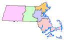
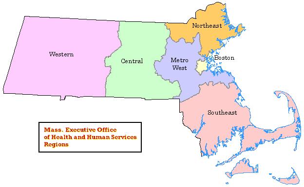
These regions are used by the Department of Public Health for statistical, care coordination and administrative purposes. The regions - Western, Central, Northeast, Metro West, Boston and Southeast - are based on geographical groupings of cities and towns (see map).
The two feature classes - polygon and arc - are stored in ArcSDE as REGEOHHS_POLY and REGEOHHS_ARC.
The polygon feature class was updated in August 2021 to be based on the Survey Towns Boundaries (previously based on the USGS-based town boundaries).
Production
MassGIS received a list of town IDs and associated regions from staff at the Department of Public Health, Office of Data Management and Outcomes Assessment (ODMOA) and joined it to the Municipalities layer. The layer was then dissolved by region to produce the six multi-part polygons in ArcMap. Population values were summed across each region and joined to the layer. Arcs were coded in coverage format in ArcInfo Workstation and converted to a geodatabase feature class.
Attributes
The polygon attribute table contains the following fields:
| Field | Width/Type | Description |
|---|---|---|
| REG_NUM | 1 / I | EOHHS Region Number (1-6) |
| REG_NAM | 10 / C | EOHHS Region Name |
| POP1980 | 9 / I | 1980 Population of region |
| POP1990 | 9 / I | 1990 Population of region |
| POP2000 | 9 / I | 2000 Population of region |
| POP2010 | 9 / I | 2010 Population of region |
The arc attribute table contains the following items:
| Field | Width/Type | Description |
|---|---|---|
| OUTLINE | 1 / I | Boundary type: 9 = EOHHS Region boundary 1 = State outline 4 = Coastline |
Related Database Table
The table REGEOHHS_POLY_TOWNS identifies which towns fall within each EOHHS region. Items include:
| Field | Description |
|---|---|
| TOWN_ID | Municipality ID, from Municipalities layer |
| TOWN | Municipality name, from Municipalities layer |
| REG_NUM | EOHHS Region Number (1-6) |
| REG_NAM | EOHHS Region Name |
Maintenance
The Massachusetts Department of Public Health will provide any updates to MassGIS. The March 2019 update of this layer includes the populations from the 2010 Census.
MassGIS updated the data in April 2022 to reflect recent edits to the Municipalities layers.