Downloads
.zip file (2.9 MB), with ESRI Shapefiles (arc and polygon) and ArcMap layer file (.lyr)
Overview
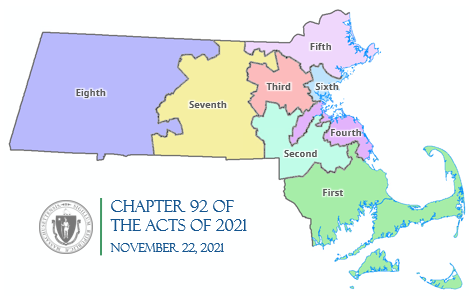
Staff at the Massachusetts General Court Special Joint Committee on Redistricting developed this layer. Governor Baker signed the new districts into law on November 22, 2021, with Chapter 92 of the Acts of 2021.
The name of the statewide datalayers are GOVCOUNCIL2021_POLY (polygons) and GOVCOUNCIL2021_ARC (linear features).
Production
MassGIS downloaded the data from the Joint Committee on Redistricting website and incorporated a coastline into the polygons using 2020 TIGER/Line "faces" data downloaded from the U.S. Census Bureau. MassGIS converted the polygons to linear features to produce the _ARC feature class and added attributes to both feature classes.
The data layers are based upon 2020 U.S. Census geography and therefore will not perfectly align to MassGIS's Municipalities layer (nor any others based on it).
Attributes
The GOVCOUNCIL2021_POLY attribute table has the following fields:
| Field Name | Width / Type | Description |
|---|---|---|
| DIST_NUM | 16 / C | Numeric district code from redistricting committee |
| DIST_NAME | 16 / C | Name of district |
| MEMBER | 2 / C | Name of Councilor |
| PARTY | 25 / C | Political party of councilor |
In the GOVCOUNCIL2021_ARC attribute table, the field OUTLINE is coded as follows:
- 0 = internal district boundaries
- 1 = state
- 2 = coastline
Maintenance
MassGIS maintains the layer and will make updates as needed. Member names will not be populated until the results of the November 2022 election are certified. View the districts currently in effect.
Additional information, file formats, and PDF maps can be found on the Joint Committee on Redistricting website.