Downloads
Overview
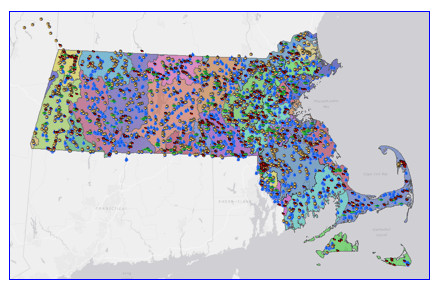
The Federal Clean Water Act (CWA) directs states to monitor and report on the condition of their water resources. The Water Quality Monitoring Stations data layer was compiled by MassDEP staff in fulfillment of CWA mandates. The stations data layer represents water quality monitoring locations sampled by WPP staff from 1983 to 2022.
Four types of WPP monitoring stations are detailed below. Each station, stored as a single point in the data layer, represents a location that was sampled on one or more occasions during one or more years by WPP staff or their agents:
Fish Toxics Stations: 1983-2022 (n=446); locations where whole fish were collected for subsequent tissue analysis of one or more contaminants. Coverage may include MassDEP Office of Research & Standards (ORS) Mercury Project sampling locations if also sampled by WPP.
Fish Population Stations: 2005-2011 (n=177); locations where fish were collected, identified, measured, and released and where habitat quality conditions have been recorded. Locations for 2012-2022 sampling will be provided in a future update.
Benthic Macroinvertebrate Stations: 1983-2022 (n=1290); locations where samples of benthic macroinvertebrates have been collected for subsequent subsampling and taxonomic identification and where habitat quality conditions have been recorded. (“Macroinvertebrate” is defined to include all aquatic members of the Annelida; all aquatic Mollusca; aquatic macro-Crustacea; aquatic Arachnida; and the aquatic life stages of Insecta—the exception being the Collembola, Hemiptera, and adult Coleoptera other than Elmidae).
Water Quality Stations: 1994-2022 (n=3111); locations where water quality monitoring has been conducted, including one or more of the following data types: discrete or continuous in-situ probe measurements (e.g., dissolved oxygen, temperature, pH, specific conductance); laboratory results for water samples (e.g., bacteria, nutrients, algal toxins, metals, organics); or general site observations. Note: for display purposes, stations are differentiated into two major types: Surface Water (e.g., River/Stream, Lake, Estuarine) or Discharge (e.g., Facility Industrial, Facility Municipal Sewage (POTW), Storm Sewer).
Stations can overlap if they were monitored for more than one survey type.
Learn more about the WPP water quality monitoring program.
The data layer is named DWMWPP_WATER_QUALITY_STATIONS.
Production
The data layer was created using field descriptions and/or coordinates recorded by WPP staff from handheld-global-positioning system devices or using coordinates generated following a systematic random-point-selection process developed by the Environmental Protection Agency (EPA) Office of Research and Development, Western Ecology Division.
When geo-referencing using Geographic Information Systems began in the 1990s, stations were placed as points on water features as represented on the 1:25,000 U.S. Geological Survey (USGS) topographic quadrangle images maintained by MassGIS. If a water feature was not depicted on the quadrangle, then ortho photo images were used to place the point and documentation was added to the descriptor (e.g.,”…stream not apparent on quadrangle…”). Points depicting stream monitoring stations are representative of an approximate 100-foot reach, assuming no obvious changes to water quality from other water sources (e.g., tributaries, National Pollutant Discharge Elimination System (NPDES) permitted discharge outfalls). Points depicting lake monitoring stations are representative of actual locations sampled (e.g., deep-hole, shoreline) or are placed at a central point as a general locator for monitoring types that encompass the whole water body (e.g., fish toxics). Points depicting discharges are placed at the mouth of the outfall prior to mixing with the receiving water.
After initial station placement, field staff reviewed mapped points to ensure placement agreed with field notes. The systematic random-point-selection process is used when a probabilistic design monitoring project occurs. Sampling points are generated either from the 1:100,000 National Hydrography Dataset Plus coverage (NHD-Plus-coverage), or from the higher resolution 1:24,000 NHD-Plus-coverage, following the EPA’s protocols. Randomly selected points were not adjusted to fall on quadrangle-imaged waters, therefore some of those stations may appear to be “on dry land” when stations are overlaid on the quadrangle images.
Attributes
The layer's point attribute table contains the following fields:
| Field name | Description |
|---|---|
| VINTAGE | (alias: Vintage) The date the station information was extracted from WPP’s Station Database. |
| SURVEYTYPE | (alias: Survey Type) Monitoring survey data type for which the station was registered (e.g., Benthic Macroinvertebrate, Fish Population, Fish Toxics, Water Quality surveys). |
| WPP_BASIN | (alias: DWM-WPP Watershed Name) Name of the MassDEP WPP watershed/coastal drainage area where the station is located. The WPP watershed delineations are modified from the MassGIS ‘Major Basins’ layer to reflect surface water drainage areas used to develop the Massachusetts Integrated Report: Multi-part List of Waters (IR). |
| UNIQUEID | (alias: Unique ID) Unique identifier code assigned by WPP for the monitoring station. |
| WATERBODY | (alias: Waterbody Name) Station waterbody name(s) based on MassDEP’s inventory coding systems (SARIS: Stream and River Inventory System; PALIS: Pond and Lake Inventory System; CAMIS: Coastal and Marine Inventory System). Names are separated by ‘/’ if, for example, a monitoring station is on a named impoundment on a stream. For discharges, including pipes, the waterbody name indicates the receiving water. |
| STADESCRIP | (alias: Station Description) Station location description. |
| STATYPE | (alias: Station Type) Station location type name (e.g., lake, river, discharge pipe, etc), consistent with EPAs Water Quality Exchange (WQX) domain values used for submitting data to the Storage and Retrieval (STORET) Data Warehouse. |
| STATYPEGRP | (alias: Station Type Group) Grouping of station location type as ‘Surface Water’ or ‘Discharge’ for display purposes. |
| WATERCODE | (alias: Waterbody Code) Unique water body code(s) based on MassDEP’s inventory coding systems (SARIS, PALIS, CAMIS). Codes are separated by ‘/’ if, for example, a monitoring station is on a named impoundment on a stream. If a water body is not listed in any of the published inventory systems, then the water code is the “BASINCODE (described below)” followed by zeroes (with SARIS having a total of seven digits and PALIS or CAMIS having a total of five digits). |
| ESTABLISH | (alias: Year Established) The year the station was first registered for sampling (i.e., systematically tracked in a database and in GIS) by WPP staff. Locations may have different established years depending on the type of sampling conducted. |
| BASINCODE | (alias: Watershed Code) The first two digits of the WATERCODE that identifies the watershed/coastal drainage area where the station is located. |
| WATERSHED | (alias: Watershed Name) Name of the SARIS-PALIS-CAMIS watershed/coastal drainage area where the station is located. |
| LONGITUDE | (alias: Longitude) Longitude (decimal degrees; North American Datum (NAD), 1983) |
| LATITUDE | (alias: Latitude) Latitude (decimal degrees; North American Datum (NAD), 1983) |
The water quality monitoring stations should be displayed with the MassDEP DWM WPP watersheds data layer (included in the download at the top of this page). Those delineations, represented in IL_DWMWPP_WATERSHEDS_POLY, are based on MassGIS 'Major Basins' layer but modified by WPP to reflect surface drainage areas used for the Massachusetts Integrated Report: Multi-part List of Waters (IR). Fields in the IL_DWMWPP_WATERSHEDS_POLY attribute table are as follows:
| Field name | Description |
|---|---|
| DWM_Name | (alias: DWM-WPP Watershed Name) The MassDEP WPP watershed delineations are based on the MassGIS ‘Major Basins’ layer; modified to reflect surface drainage areas for use with the Massachusetts IR by the WPP. For example, a portion of the Cape Cod Coastal Drainage Area was changed to reflect its drainage into the Buzzards Bay Coastal Drainage Area, resulting in shape changes for both the Cape Cod and Buzzards Bay watershed delineations. In general, the watershed name is based on the Massachusetts Stream and River Inventory System (SARIS) coding system that includes all Massachusetts river basins and coastal drainage areas (Halliwell et al. 1982). The WPP watershed name Boston Harbor (Proper) does not appear in the MassGIS ‘Major Basins’ layer or the SARIS list of watersheds; it refers to the harbor itself. Three drainage area types in SARIS --- River Basin, River Basin and Coastal Drainage Area, and Coastal Drainage Area --- are further described below (see Drainage). |
| DWM_Code | (alias: Watershed Code) The watershed identification code used by the WPP to assign waterbody Assessment Units (AUs) within a watershed. These codes are assigned according to the Massachusetts Stream and River Inventory System (SARIS) -- the first two numbers of which assign 1. the major drainage system and 2. the river basin and/or coastal drainage area (the sub-basin) (Halliwell et al. 1982). |
| Drainage | (alias: Drainage) Three drainage area types are further described in SARIS as follows: River Basin: Major inland river basin; River Basin and Coastal Drainage Area: Major inland river basin coupled with smaller areas draining directly to coastal waters within the general geographic area of the associated river basin; Coastal Drainage Area: Subdivisions of the coastal drainage system that have been partitioned into specific geographic areas. These areas all drain to coastal waters but may have multiple small-scale drainages (Halliwell et al. 1982). |
References
Ackerman, M.T., R.A. Batiuk, and T.M. Beaudoin. 1984. Compilation of Lakes, Ponds, Reservoirs and Impoundments relative to the Massachusetts Lake Classification Program. Publication: #13786-216-30-8-84-c.r. Technical Services Branch, Massachusetts Division of Water Pollution Control, Department of Environmental Quality Engineering, Westborough, Mass.
Ackerman, M.T. 1989. Compilation of Lakes, Ponds, Reservoirs and Impoundments Relative to the Massachusetts Lake Classification Program. Publication: #15901-171-50-4-89-c.r. Technical Services Branch, Massachusetts Division of Water Pollution Control, Department of Environmental Quality Engineering, Westborough, Mass.
Halliwell, D.B., W.A. Kimball and A.J. Screpetis. 1982. Massachusetts Stream Classification Program Part I: Inventory of Rivers and Streams. Massachusetts Division of Fisheries and Wildlife, Department of Fisheries, Wildlife, and Recreational Vehicles and Massachusetts Division of Water Pollution Control, Department of Environmental Quality Engineering. Westborough, MA.
MassDEP. Unpublished. Coastal and Marine Inventory System (CAMIS): Compilation of Non-SARIS/PALIS Identified Estuarine Waters. Massachusetts Department of Environmental Protection, Division of Watershed Management. Worcester, Mass.
Maintenance
The MassDEP WPP is maintaining this data layer. Periodic updates are anticipated as monitoring years are completed and station mapping is verified by sampling staff. For further information about this data layer and other data associated with these stations, contact Richard Chase (617-894-6138) in the MassDEP WPP.