Downloads
Overview
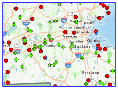
Massachusetts is blessed with more than 1,200 miles of seashore and hundreds of lakes, ponds, and streams. The Office of Fishing and Boating Access (OFBA) in the Massachusetts Department of Fish and Game (DFG) is charged with providing access to these many waterways. Presently, the agency oversees boat and canoe launch sites at more than 200 coastal and inland locations in Massachusetts.
The principal source for this layer is produced by OFBA. Additional sites have been digitized from USGS topographic quadrangles.
The layer is named OFBA_PT. With the January 2008 release it replaces the Public Access Board Sites (PAB_PT) layer.
Attributes
The datalayer has a point attribute table with the following fields:
| FIELD | Description |
|---|---|
| OFBA_ID | Unique site ID assigned by the OFBA |
| TOWN | Town Name |
| FACNAME | Facility name |
| FACILITY_TYPE | Type of facility: |
| A - GENERAL ACCESS: Concrete boat ramp and parking for boat trailers. | |
| B - FISHERMAN ACCESS: Small concrete ramp, concrete pad ramp system or gravel ramp designed for smaller boats and parking for boat trailers. | |
| C - CARTOP ACCESS: Access to lakes, ponds and rivers for small boats, canoes and kayaks. | |
| D - CANOE ACCESS: Access to rivers most suitable for canoes and kayaks. | |
| E - SPORT FISHING PIER: Pier that provides fishing area for recreational anglers - barrier free. | |
| F - SHORE FISHING AREA: Minimally improved property that provides shore fishing access. | |
| MAINTRESP | Maintenance and management responsibility |
| RAMPTYPE | Launch ramp type (Cartop, Concrete, Gravel, Other) |
| GOOGLE_MAP | Directions from Google Maps |
| PONDMAP_LINK | Link to pond map |
| NOLANES | Number of lanes |
| NORAMPS | Number of ramps |
| CONDITION | Condition of ramp |
| FEE | Fee required? (some records are null; data not yet complete) |
| STREET_PERMITED | Sticker or permit required? (some records are null; data not yet complete) |
| RESTRICTED | Restrictions? (some records are null; data not yet complete) |
| PARKING | Number of parking spots |
| COMMENTS | Comment field |
| DATE_ENTER | Date entered in Public Access to the Waters of Massachusetts |
| QUADS_ID | USGS Quad ID |
| QUAD_NAME | USGS Quad name |
| DOUBLEQUAD | USGS Double quad name |
| FISH_CODES | Fishing codes: |
| 1 - Trout | |
| 2 - Largemouth Bass | |
| 3 - Smallmouth Bass | |
| 4 - Northern Pike | |
| 5 - Tiger muskee | |
| 6 - White perch | |
| 7 - Pickerel | |
| 8 - Black crappie | |
| 9 - Walleye | |
| 10 - Striped bass | |
| 11 - Bluefish | |
| 12 - Bonito | |
| 13 - False albacore | |
| 14 - Tautog | |
| 15 - Fluke | |
| 16 - Cod | |
| 17 - Flounder | |
| 18 - Squeteague - weak fish | |
| 19 - Shortnose Sturgeon | |
| PAGE | Page in Public Access to the Waters of Massachusetts |
| SITEMAP_NAME | Name of site map |
| COASTAL_ACCESS | Indicates Coastal Access. |
| BARRIER_FREE | Barrier free (Yes/No) - No barrier to access for people with disabilities. (some records are null; data not yet complete) |
| PENDING | Completed? |
| TOWN_ID | Town ID |
| POINT_Y | Latitude coordinate in decimal degrees |
| POINT_X | Longitude coordinate in decimal degrees |
Maintenance
Maintained by DFG GIS program in cooperation with the Office of Fishing and Boating Access. Updates are sent to MassGIS as needed. In November 2023 one point was added, and the values in the RAMPTYPE field were modified to include only four values, including all "N/A" types recalculated to "Other."
The attribute table was altered in the April 2024 release (published by MassGIS on 5/20/2024).