Downloads
Overview

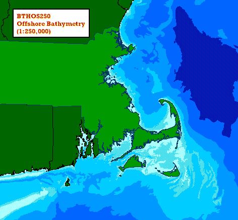
This datalayer represents bathymetry data - seafloor topography - for ocean waters off the coast of Massachusetts. The layer was created by EOEEA Coastal Zone Management analysts for graphic display purposes only and is general in nature; it should not be used for navigation. Polygons were delineated from a 1:250,000 USGS regional map. Ocean depth measurements are in meters. The dataset is stored in ArcSDE as BTHOS250_POLY.
Attributes
The datalayer's polygon attribute table has the following items:
| Field name | Description |
|---|---|
| DEPTH_NOS | Code number for depth range (see table below) |
| DEPTHRANGE | Text field indicating depth below sea level, in meters |
| Field name | Description |
|---|---|
| DEPTH_NOS | DEPTHRANGE |
| 1 | Above-15m |
| 2 | -15m to-25m |
| 3 | -25m to-40m |
| 4 | -40m to-90m |
| 5 | -90m to-200m |
| 6 | Below -200m |
Maintenance
The layer is being maintained by MassGIS.
For more detailed offshore bathymetry see the Bathymetry of the Gulf of Maine datalayer.