MaGICC September Meeting
The Massachusetts Geospatial Information Coordinating Committee met on September 23, 2025. This was the Council’s second meeting. MaGICC will be focused on policy issues to guide the Commonwealth’s geospatial ecosystem, often referred to as the Massachusetts Spatial Data Infrastructure (MSDI). At this meeting, the Council discussed a global ends statement that defines the overall ends, or objectives, MaGICC aims to achieve. This statement of ends, distinct from means, will serve as the foundation for all other MaGICC policy work.
Leading up to this meeting, the Council reviewed and prioritized a list of 24 policy issues. The policy issues ranked as highest priority are:
- Governance
- Data Stewardship
- Data Sharing
- Data Maintenance
MaGICC is working now on a draft policy statement to define a recommended policy on collaborative governance for the Commonwealth’s shared geospatial ecosystem. Most organizations in the public and private sectors are organized in nested silos, as in the graphic below. But the activities we need to accomplish, which are often supported by a shared spatial data infrastructure, cut across the silos. Collaborative governance of the spatial data infrastructure will help all organizations better manage the activities that cross the silos.
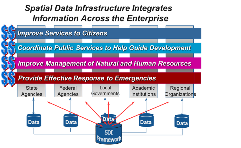
Collaborative governance for the MSDI is primarily a formal recognition of decision rights…who makes which decisions, how decisions are made, what triggers the need for a decision, who sits at the decision-making table, etc. There is no existing precedent for such a collaborative governance structure that involves all the stakeholder sectors. MaGICC and a committee structure that supports it is such a collaborative governance structure. The Council will take up other policy issues in priority order moving forward.
Geospatial Professional Network (GPN) Conference
The Geospatial Professional Network of New England (GPN-NE) held a one-day conference at Bridgewater State University on September 19, 2025. GPN-NE, formerly known as New England URISA, is a regional hub for geospatial professionals, offering networking opportunities, educational events, and professional development.
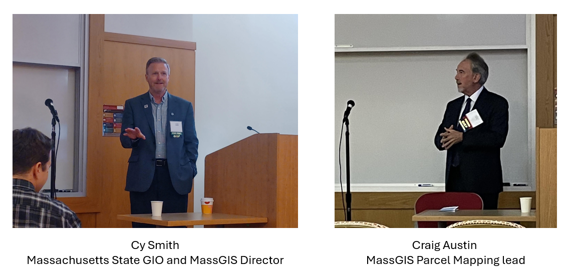
The conference featured a wide selection of topics that provided insights into the many aspects of the geospatial ecosystem, including geospatial technology, geospatial data development and management, and use case perspectives from across the region. Cy Smith, the Massachusetts State GIO and MassGIS Director, gave a keynote talk about the U. S. National Spatial Data Infrastructure (NSDI). Cy talked about the importance of the NSDI for the nation, including all organizations in the public and private sectors. He spoke to the need for improving support for small and rural local governments in participating in the NSDI through the use of GIS and geospatial data to meet their missions.
Craig Austin, the MassGIS Parcel Mapping lead, also made a presentation at the conference. Craig talked about the state’s parcel mapping standard, provide some information about the parcel dataset structure, and spoke to the return on investment from implementing the standard. The conference included a poster display showing many excellent demonstrations of map making skills to tell important stories and illustrate geospatial use cases. There were many geospatial vendors sponsoring the conference and displaying their solutions throughout the day. And there was a Mappy Hour at a local establishment off campus where the participants socialized a bit and shared stories of their experiences from various organizations that use geospatial tools and data.
MassGIS and Census 2030
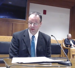
While 2030 is still years away, the Commonwealth is already starting to prepare for the decennial effort that counts the population and ultimately determines representation at all levels of government and how trillions of dollars in funding is distributed. The Massachusetts Senate Committee On The Census began holding informational hearings this past summer, and MassGIS was invited to present at a more recent one held on September 22nd. At this hearing, MassGIS' Senior GIS Specialist and Database Architect, Dan Marrier, provided the committee with an overview of its Master Address Database (MAD) and how it is being used to support the state's Census preparations. MassGIS has collaborated with both the UMass Donahue Institute and the Secretary of the Commonwealth's Census Division in Census-related activities for several years. Leveraging the value of the MAD's 3.5 million+ standardized addresses and locations, our data partners have experienced tremendous success in outreach efforts like LUCA and in performing the statistical and logistical operations that ensure the count of Massachusetts residents is as complete as possible. We encourage everyone to continue their cooperation with those organizations and to keep sending MassGIS address updates to maximize the benefits to the Commonwealth that rely on this work.
Data Updates
- Trains October 31, 2025 - Updated the Commuter Rail point and line data to reflect the opening of the South Coast Rail route and made other spatial and attribute edits.
- Property Tax Parcels October 22, 2025 - 22 municipalities: Ashland, Berlin, Brewster, Canton, Cohasset, Dartmouth, Franklin, Gloucester, Hopedale, Lanesborough, Lynn, Monterey, Oxford, Palmer, Sheffield, Swansea, Topsfield, Truro, Tyringham, Wareham, Warren, and Wendell.
- National Wetlands Inventory September 23, 2025 - New data from the U.S. Fish & Wildlife Service as of 5/7/2025.
- RMV Locations September 22, 2025 - MassGIS moved the point for the Braintree Service Center to its new location. July 14, 2025 - MassGIS moved the point for the Revere Service Center to its new location in Chelsea. June 23, 2025 - MassGIS moved the point for the Milford Service Center to its new location.
- MassDEP data layers September 15, 2025 - Updates to the Public Water Supply Sources and Wellhead Protection Areas (Zone II, Zone I, IWPA) data, current as of 9/3/2025.
- MassDEP data layers August 28, 2025 - Updates to the Groundwater Discharge Permits data, current as of 8/27/2025, MassDEP Tier Classified Oil and/or Hazardous Material Sites (MGL c. 21E), and MassDEP Oil and/or Hazardous Material Sites with Activity and Use Limitations (AUL) data, current as of 8/26/2025
- Ice Rinks August 11, 2025 - Extensive update and overhaul of the ice rinks dataset
Events and Announcements
Registration Open- OpenStreetMap'sMapping USA 2026will be held online on January 30-31, 2026.
Registration Open- FOSS4GNA (Free and Open Source Software for GeoSpatial) annual U.S. Conferencewill be held online on November 3-5, 2025, in Reston, VAClick to edit this placeholder text.
Contact
Online
Address
| Date published: | November 13, 2025 |
|---|