Stage Harbor, Chatham
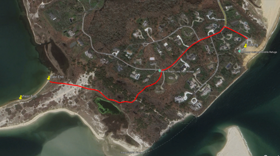
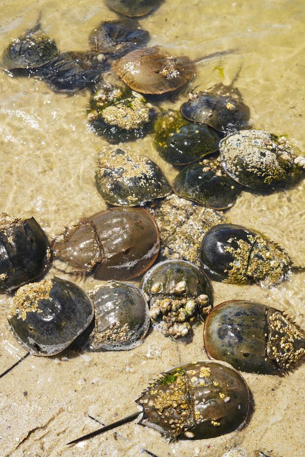
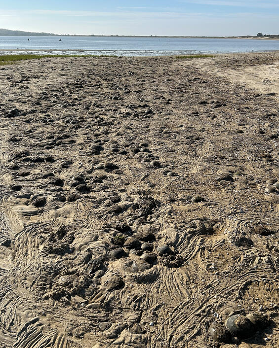
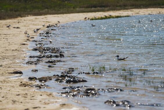
Just inside of the Stage Harbor inlet, on either side (east or west side), is a great place to observe spawning horseshoe crabs, though both locations require about a 0.75 mile walk from the nearest parking lot (see map above). To access the east side of the inlet, free parking is available at the Monomoy National Wildlife Refuge’s property at 30 Wikis Way, in Chatham. Walk back towards the road and turn left, down Tisquantum Road. In about a quarter mile there will be a dirt path (Morris Island Loop Trail) on the left side of the road. Follow that trail down the hill and then bear right when you get to the saltmarsh. Follow the trail over the dune to Stage Harbor. The overall walk is about ¾ of a mile on pavement, hard sand, and loose sand. This location is a site that is monitored annually as part of the Massachusetts Horseshoe Crab Spawning Beach Survey.
On the west side of the inlet, park at the easternmost section of the Hardings Beach parking lot (located at the end of Hardings Beach Road) and walk east to the channel. The walk is about ¾ of a mile across sand. High densities of crabs can be found along the inlet, often increasing in number as you go further northeast along the Stage Harbor entrance channel. Check for parking information.
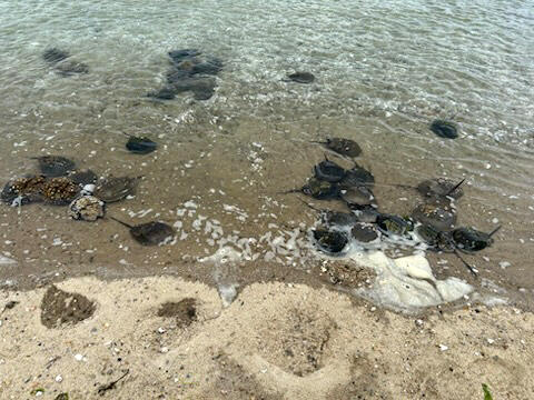
Stage Harbor West
Stage Harbor East.
Ridgevale Beach, Chatham
Located at the end of Ridgevale Road, park at the beach parking lot and walk over the foot bridge and walk east along the creek towards the creek mouth. More crabs are often visible near or along the channel mouth, which is a 0.2 mile walk from the parking lot. Check for information on parking.
West Dennis Beach, Dennis
Park at the westernmost West Dennis Beach parking lot, at the mouth of Bass River. Crabs can be found very close to the parking lot by walking north along the river, or south, towards the river mouth along the sandy spit south of the parking lot. This site is monitored annually as part of the Massachusetts Horseshoe Crab Spawning Beach Survey. The town charges for parking from Memorial Day weekend through Labor Day, with additional restrictions due to piping plovers. Check for more information.
Millway Beach, Barnstable
The Millway Beach parking lot is only open to Barnstable residents and requires a town sticker year-round. The beach parking lot is located steps from the beach. Crabs can be found during the spawning season from the Bliss Point boat ramp to east of the parking lot. This site is monitored annually as part of the Massachusetts Horseshoe Crab Spawning Beach Survey.
Duxbury Beach, Duxbury
There is parking on either side of the Powder Point Bridge. There is free parking open to anyone (first come, first served) on the west side of the Powder Point Bridge. The better location to observe crabs is on the east side of the bridge, but parking at this location is more restricted. Check for more information on parking. The eastern side of the embayment heading north from the Powder Point Bridge is monitored annually as part of the Massachusetts Horseshoe Crab Spawning Survey.
Massachusetts Horseshoe Crab Survey Trends and Commercial Fishery Monitoring
MA DMF monitors the abundance of horseshoe crabs through three different surveys, the MA DMF Resource Assessment Spring and Fall Trawl Survey, the MA DMF Resource Assessment Seine Survey, and the Massachusetts Horseshoe Crab Spawning Beach Survey. The trawl survey started in 1978 and operates in May and September across state waters. The seine survey started in 1976 but has consistently collected horseshoe crab data since 1984. The survey is conducted in early summer at six embayments along the south side of Cape Cod. The spawning survey is volunteer-based, depending on numerous partner organizations (Mass Audubon, North and South Rivers Watershed Association, Southeastern Massachusetts Pine Barrens Alliance, USFWS, Maria Mitchell Foundation, and Nantucket Conservation Foundation) and hundreds of volunteers annually. The survey, which started in 2008, occurs at 16 different locations, mostly on the Cape and Islands, with survey dates scheduled at high tide during the new and full moons of May and June.
The abundance of crabs in Massachusetts has been increasing, so you’re more likely to see larger numbers of crabs than you would have years ago. Over the last decade, 90% of Massachusetts spawning surveys are showing an increasing trend. The MA DMF’s annual seine survey has seen above normal numbers of crabs each of the last ten years. The Atlantic States Marine Fisheries Commission conducts periodic horseshoe crab stock assessments for horseshoe crabs along the U.S. Atlantic Coast. The last two assessments (2019 and 2024) stated that abundance in Massachusetts has been increasing since horseshoe crab management started in 1998, citing data from the MA DMF Resource Assessment Trawl Survey.
MA DMF also monitors the commercial horseshoe crab fishery through tracking landings, sampling crabs in bait markets and biomedical facilities, and observing the biomedical industry during horseshoe crab collection and release trips. MA DMF began market sampling at bait dealers and biomedical facilities in 2000, but increased sampling effort to include at-sea observations of the biomedical collection and release trips in 2022, when a second biomedical firm opened in Massachusetts. Prior to 2022, there had been one biomedical firm in the state, which opened in 1974.
For more information, contact Derek Perry at derek.perry@mass.gov