Location listing filters
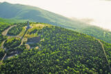
Map for Wahconah Falls State Park
Note for screen reader users, we suggest skip the following interactive map and go to the location listing for a better user experience.
Currently, the map is not accessible yet for a comprehensive experience.
skip to the location listing
Location Listing
Showing 1 - 3 of 3 results for Other locations related to Wahconah Falls State Park
-
Mount Greylock State Reservation
- Wheelchair Accessible
30 Rockwell Road, Lanesborough, MA 01237 DirectionsAt 3,491 feet, Mount Greylock is the highest point in Massachusetts. From its peak on a clear day, you can see as far as 90 miles away. No matter when you visit, there's plenty to do and see.Phone(413) 499-4262-
Park is open dawn to dusk
-

October Mountain State Forest
317 Woodland Road, Lee, MA 01238 DirectionsAt 16,500 acres, October Mountain is the largest state forest in Massachusetts. You'll find trails for any level of hiking experience, and you can also visit nearby Tanglewood, popular music venue and home to the Boston Symphony Orchestra.
Phone(413) 243-1778-
Sunrise to one half-hour after sunset
-
-

Windsor State Forest
River Rd., Windsor, MA 01096 DirectionsLocated in the rolling hills of the Berkshires, Windsor State Forest provides visitors with the relaxation of deep woods trails, views of the scenic Westfield River, historic CCC-era architecture, and sunny fields for picnic and play. A short hike takes guests up to the Windsor Jambs waterfall, featuring the Windsor Jambs Brook cascading between 80 foot high granite walls.Phone(413) 684-0948-
Sunrise to sunset
-