- Department of Conservation & Recreation
Media Contact
Peter Jasinski, DCR Press Secretary
BOSTON — In an effort to promote enjoyment of state parks in all seasons, the Department of Conservation and Recreation (DCR) today announced that the Interactive Fall Foliage Map, has been updated for the 2025 fall season. The map enables residents and visitors to plan their foliage viewing by providing updates on peak foliage conditions at DCR properties across the state.
“Fall is one of the most beautiful times of the year in New England and people come from all over the world to see the changing leaves at our beautiful state parks,” said DCR Commissioner Nicole LaChapelle. “This year’s interactive fall foliage map shows when peak changes will occur, so whether you’re planning a day trip or a weekend getaway to one of our parks, you can make the most of the vibrant colors of the fall season.”
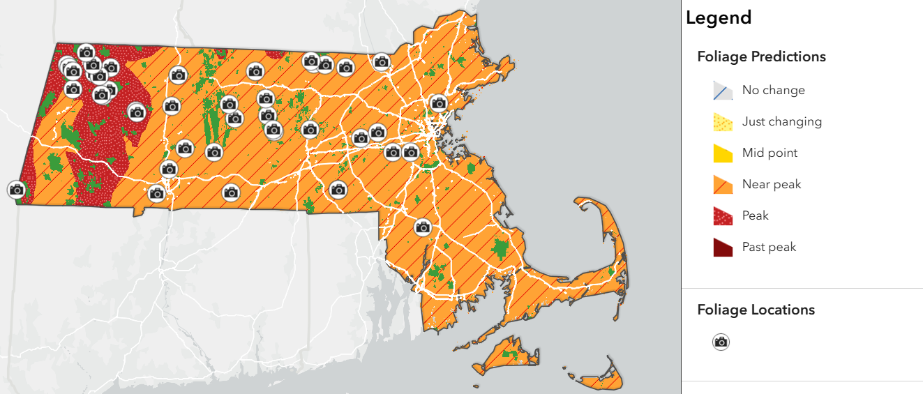
The Interactive Fall Foliage Map can be used by selecting various calendar dates to see which sections of the state, including specific DCR properties, will experience peak fall colors during that time. By analyzing current conditions and data from past years, DCR forestry staff can predict approximately when the leaves in each area will change color throughout the season, including when they will reach their peak. This year, most of the state will see peak colors in mid-October, with certain areas in Western Massachusetts peaking slightly earlier. The map also displays photos taken by DCR staff, allowing visitors to get a preview of what they might see during their excursion.
The Interactive Fall Foliage Map is optimized for use on desktop and mobile devices, ensuring accessibility for all users, and can be found online at DCR’s Fall Foliage webpage. DCR’s social media channels will also regularly share foliage content throughout the season.
DCR’s Fall Foliage webpage also highlights 17 recommended foliage viewing spots in the state park system, along with hiking trails, picnic areas, and scenic overlooks at the locations.
###