- Division of Ecological Restoration

Beyond the wooden fence, ferns, and poison ivy lining Southwick Road in North Reading, Massachusetts, a narrow stream flows beneath the road through a pipe most drivers never notice. This road-stream crossing, commonly referred to as a culvert, is designed to carry the stream under the road.
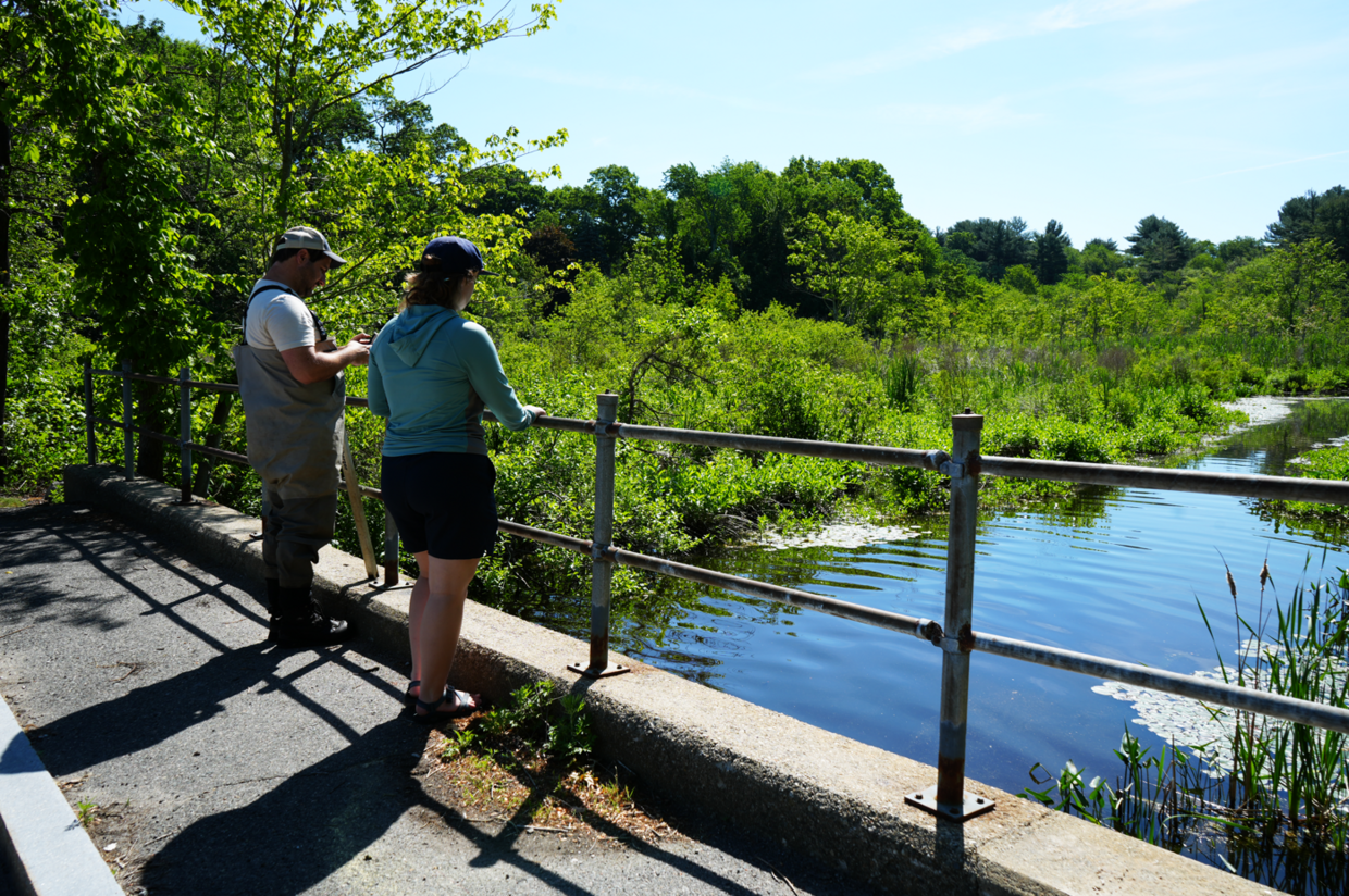
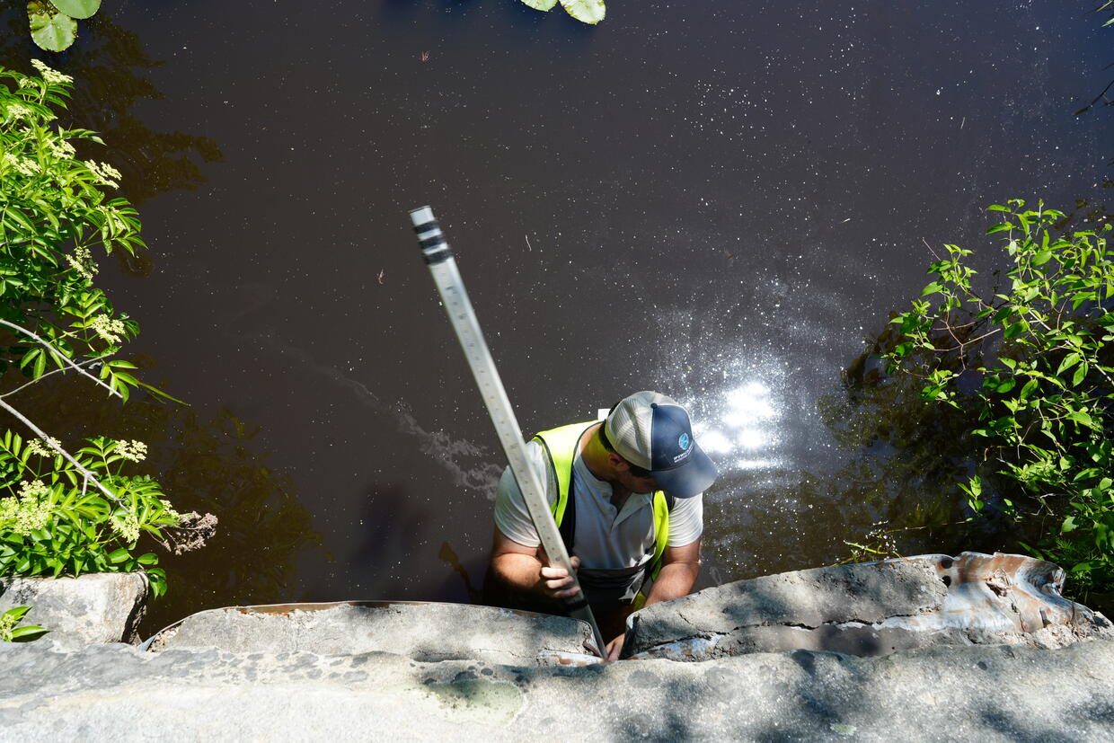
Standing in the water below, Neil Shea steadies a surveying rod and calls out measurements. He’s wearing chest waders and a sun-bleached hat with Ipswich River Watershed Association (IRWA) stitched on the front.
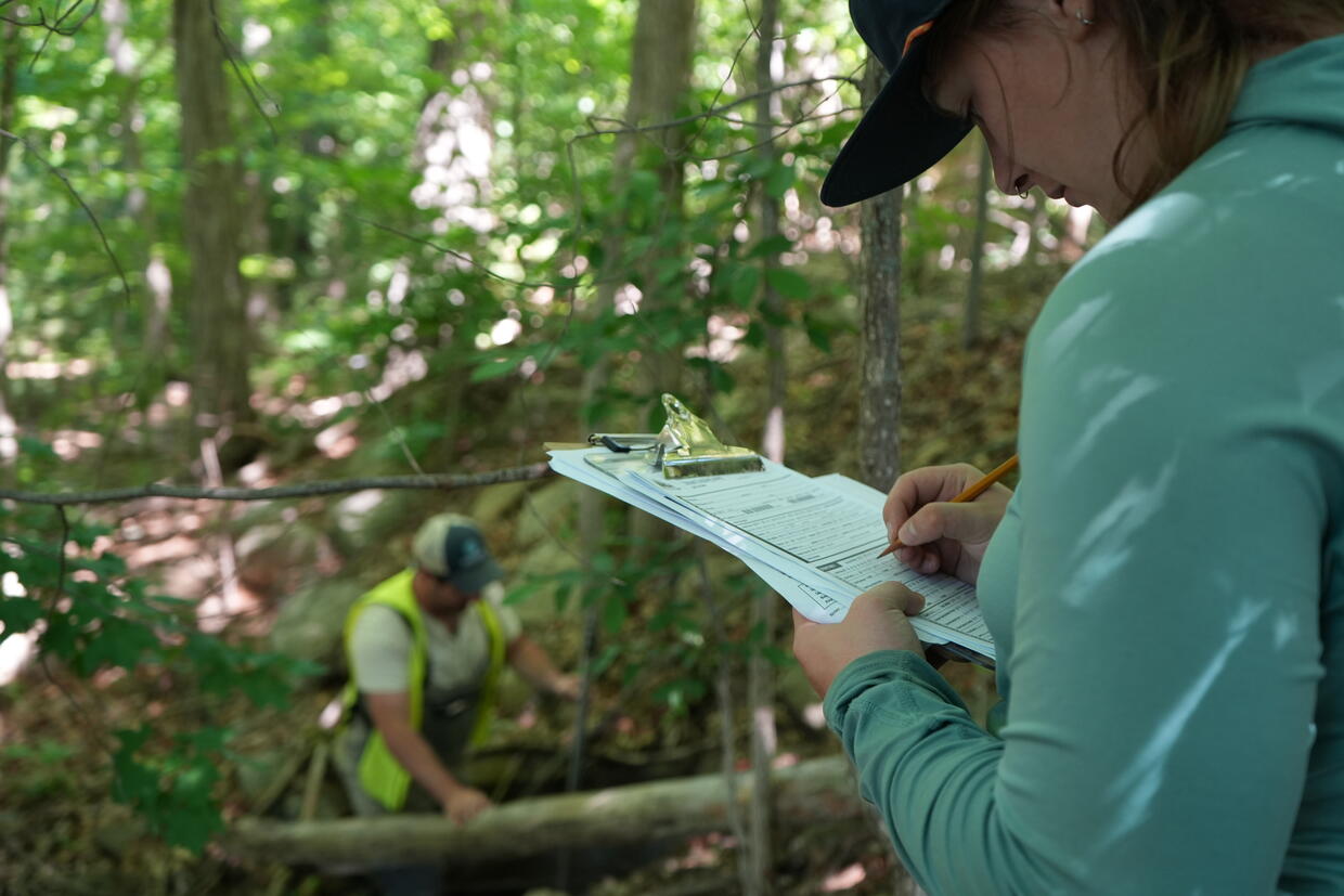
Above him, 22-year-old intern Fiona Monahan leans over the guardrail, pencil and clipboard in hand, noting culvert material, water depth, level of blockage, channel alignment, and crossing type. The pair will assess dozens of culverts before the day is over, just a fraction of the estimated 25,000 culverts scattered across Massachusetts.
“Most people drive over these crossings every day without ever seeing them,” says Shea, Restoration Program Director for IRWA. “But when you get down in the stream, you realize how much a single culvert can affect flooding, fish movement, and the health of the whole river. These small structures matter more than people think.”
Hiding in plain site
Every day, Massachusetts residents drive over thousands of road-stream crossings without realizing how critical they are to infrastructure and wildlife. Culverts and bridges quietly shape everything from flood resilience to trout and herring migration to whether turtles, salamanders, and even large animals like deer can safely move through the landscape.
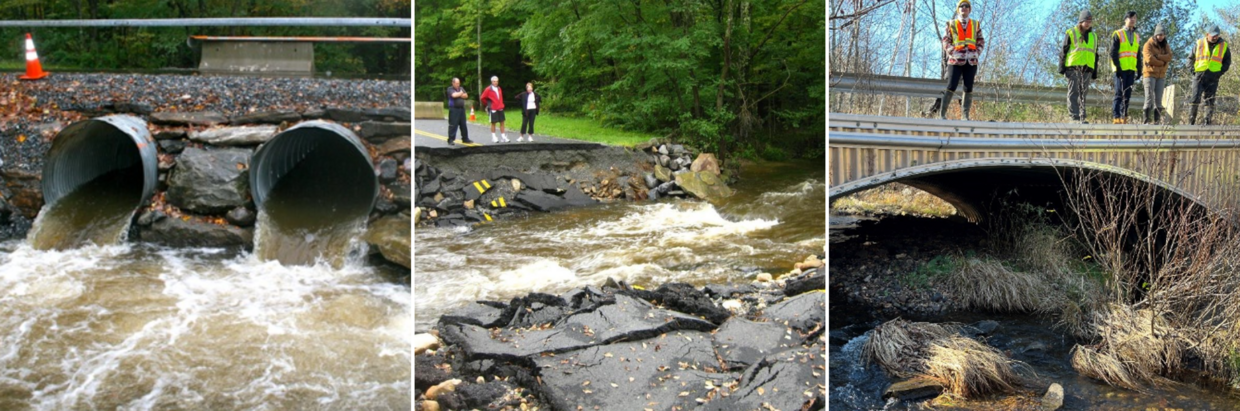
These crossings come in many forms: rusty corrugated pipes, stone arches built more than a century ago, perched pipes fragmenting habitats and creating waterfalls that fish can’t climb and eroding sediment into streams, and concrete boxes nearing the end of their lifespan. In addition to damaging habitat, undersized culverts can also threaten public safety. These culverts may back up during storms, contributing to road flooding or even destructive road blow-outs.
Many culverts in Massachusetts are undersized, degraded, or failing. Most are owned by municipalities, so cities and towns are facing expensive decisions as storms intensify with a changing climate.
Massachusetts’ latest climate assessments warn that the state is on track for more intense rainfall, more frequent extreme storms, and sharply higher winter precipitation — conditions that will push aging culverts and road crossings past their limits. As storms deliver larger volumes of water in shorter bursts and rivers see higher peak flows, undersized culverts become choke points that back up water, overtop roads, and fail under pressure, which can cut off neighborhoods and emergency access.
“Massachusetts has thousands of aging crossings, and we’re seeing more intense storms every year,” said Beth Lambert, director of the Division of Ecological Restoration. “By pairing good data with funding and technical support, we’re helping communities upgrade these structures so they’re safer, more resilient to storms and flooding, and better for wildlife.”
Identifying barriers
A good culvert allows water to pass under a road. A great culvert also allows fish and wildlife to move freely upstream and down, maintaining biodiversity and preventing habitat fragmentation. But statewide data shows that more than half of assessed culverts are moderate to severe barriers for fish and wildlife, and a similar percentage are structurally degraded.
Only about 37 percent of Massachusetts culverts have been formally assessed for both structural condition and stream connectivity. The remaining two-thirds represent unknown ecological and infrastructural vulnerabilities, a major challenge in a state that is both road-dense and river-dense.
Without data, planning and prioritization is difficult. Each unassessed culvert is a potential flood hazard, a wildlife barrier, or a future road failure waiting for the next major storm.
To close the statewide data gap, the Division of Ecological Restoration (DER) is coordinating a multi-year effort to survey road-stream crossings across Massachusetts. DER partners with engineering firms, watershed associations, regional planning agencies, and conservation nonprofits to carry out these assessments, and provides funding, training, and standardized field protocols.
The aim, says Holden Sparacino, DER’s Stream Continuity Program Manager, is to build a consistent statewide inventory of culvert condition and stream connectivity — information towns need to identify high risk crossings, plan for climate-resilient upgrades, and compete for state and federal infrastructure grants.
“Giving towns a clear picture of which culverts are prone to failure and fragment habitats is the first step,” says Sparacino. “When towns know which crossings are most vulnerable, they can prioritize projects to protect people, rivers, and wildlife.”
The state is pairing data collection with new funding pathways and technical support. Programs such as DER’s Culvert Replacement Municipal Assistance Program and EEA’s Municipal Vulnerability Preparedness grants (both housed in Eco One Stop), MassDOT’s Community Culvert Grant Program, DER’s Restoration Partnerships Program, and regional partnerships like Berkshire Wildlife Linkage’s Transportation Working Group are helping towns move from assessment to action.
“The Ipswich River and its tributaries flow through North Reading, creating an extensive network of stream crossings that support the Town’s roadway system,” said Dan O’Donnell, town engineer with the North Reading Department of Public Works. “The recent replacement of a major river crossing underscored the importance of understanding the condition of culverts and bridges throughout the community. By carefully assessing and designing these structures, the Town can meet Massachusetts Stream Crossing Standards, improve passage for fish and other aquatic wildlife, reduce flood risks, and help ensure a safe, reliable transportation network for years to come.”
Supporting the vision
As Massachusetts works to build a complete, statewide inventory of road‑stream crossings, that broad vision depends on detailed, site‑by‑site assessments. On this warm afternoon in North Reading, Shea and Monahan are contributing to that effort by gathering the measurements and observations that will help towns understand their risks and plan for future culvert replacements.
“We look at things like the height, width, water depth, water width. We also note if there is a free fall, and if so, how big it is,” Shea says. “All of the information goes into a scoring rubric that evaluates whether a culvert is undersized.”
The two move on to another crossing, one of dozens they will assess in North Reading as part of a town-wide effort funded through DER. Their work is part of a broader set of assessments underway in communities including Ipswich, Hamilton, Topsfield, Middleton, and Winchester, carried out by contracted partners such as Horsley Witten and the Ipswich River Watershed Association. Each site visit adds another piece to the statewide picture of aging infrastructure and fragmented rivers.
In the past two years, DER has funded an estimated 2,000 culvert assessments statewide.
For Shea and Monahan, the work is slow and methodical: measuring, photographing, recording, and moving on to the next crossing. But each data point helps reveal a statewide picture: a network of aging infrastructure and fragmented rivers, and a roadmap for fixing both.
“Getting off the road and into these streams is a great way to see parts of the watershed you would never otherwise see,” Shea says. “These streams don’t care about the town boundaries, which makes a regional effort like this so important. It’s all about connectivity and giving the river a chance to function the way it should. That’s the part that keeps me coming back.”