Herring River, Wellfleet and Truro, MA
For project updates, visit the Project Updates page
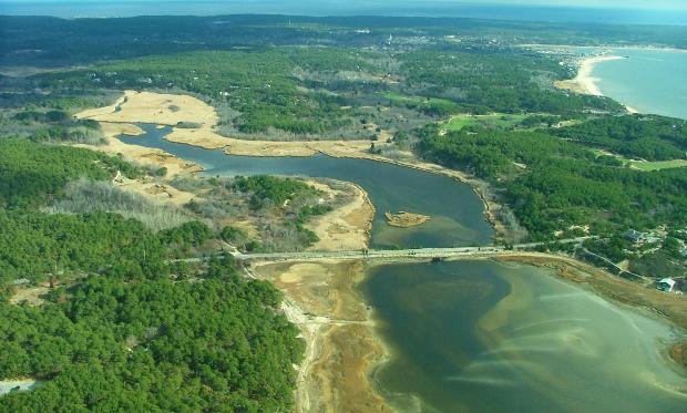
Historically, the Herring River supported a vibrant, regionally-important estuary in the Gulf of Maine and hosted one of the most important diadromous fish runs on Outer Cape Cod. Construction of a dike at the mouth of the river in 1909 and other alterations to the river system effectively eliminated tidal flow, drained the salt marshes, and transformed the estuary into one of Cape Cod’s most degraded natural resources.
DER is working with many partners to plan the restoration of the estuary by replacing the main river dike with a new structure that will allow controlled reintroduction of tidal flow while protecting existing land uses that now occupy portions of the historic flood plain. The tremendous complexity of the project, while daunting, is surpassed by its critical importance to the social, economic, and environmental well-being of the region.
Vital Statistics
Town: Wellfleet and Truro
Major Watershed: Cape Cod
Subwatershed: Herring River
Contact: DER
Partners: Towns of Wellfleet and Truro, Massachusetts Bays Program, National Park Service, US Fish and Wildlife Service, NOAA Restoration Center, Natural Resources Conservation Service, Cape Cod Conservation District, Association to Preserve Cape Cod, The Nature Conservancy, American Rivers, Ducks Unlimited, Restore America’s Estuaries, MA Corporate Wetlands Restoration Partnership, Conservation Law Foundation, Gulf of Maine Council on the Marine Environment, Friends of Herring River