Downloads
Each download includes an ArcMap 10 layer (LYR) file and Excel spreadsheets.
Overview
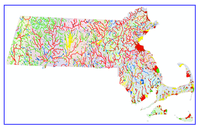
The MassDEP Division of Watershed Management (DWM), Watershed Planning Program’s (WPP) 2018/2020 Integrated List of Waters data layer provides EPA-approved water quality assessment and listing decisions for the 2018/2020 reporting cycle, as required by the Clean Water Act (CWA) under Sections 305(b), 314, and 303(d). The objective of the CWA is to restore and maintain the chemical, physical, and biological integrity of the Nation's waters. As one step toward meeting this goal each state must administer a program to monitor and assess the quality of its surface waters and provide periodic status reports to the U.S. Environmental Protection Agency (EPA).
Section 305(b) of the CWA codifies the process whereby waters are evaluated with respect to their capacity to support designated uses as defined in the Massachusetts Surface Water Quality Standards. These uses include aquatic life, fish consumption, drinking water, shellfish harvesting, primary (e.g., swimming) and secondary (e.g., boating) contact-recreation, and aesthetics. The 305(b) process entails assessing each of these uses, where applicable, for rivers, lakes and coastal waters using all readily available data and information according to the guidance available in the state’s Consolidated Assessment and Listing Methodology (CALM) manual (MassDEP 2018). States list each waterbody or portion thereof, referred to as an assessment unit (AU), in one of the following five categories:
Category 1) Unimpaired and not threatened for all designated uses.
Category 2) Unimpaired for some uses and not assessed for others.
Category 3) Insufficient information to make assessments for any uses.
Category 4) Impaired for one or more uses, but not requiring the calculation of a Total Maximum Daily Load (TMDL).
- Category 4A) Impaired for one or more designated uses but does not require the development of a TMDL: TMDL has been completed.
- Category 4B) Impaired for one or more designated uses but does not require the development of a TMDL: Other pollution control requirements are reasonably expected to result in the attainment of designated uses.
- Category 4C) Impaired for one or more designated uses but does not require the development of a TMDL: Impairment is not caused by a pollutant.
Category 5) Impaired for one or more uses and requiring a restorative “action” plan, such as a TMDL or Alternative Restoration Plan (impairment due to pollutant(s) such as nutrients, metals, pesticides, solids, and pathogens).
Waters listed in Category 5 constitute the 303(d) List. The formulation of the 303(d) List includes a more rigorous public review and comment process than does reporting under Sections 305(b) and 314, and the final version of the list must be formally approved by the EPA. Where waters are determined to be impaired, causes and sources of use impairment are identified. Once a waterbody is identified as impaired by a pollutant, MassDEP is required under Section 303(d) of the CWA to develop a pollutant limit designed to restore the health of the impaired waterbody. The process of developing the pollutant limit or maximum load, generally referred to as a Total Maximum Daily Load (TMDL), includes identifying the cause (type of pollutant) and source (where the pollutant comes from), determining how much of the pollutant is from direct discharges (point sources) or indirect discharges (non-point sources), determining the maximum amount of the pollutant that can be discharged to a specific waterbody and still meet water quality standards, and developing a plan to meet that goal. Upon implementation, TMDLs can restore water quality and enable waters to attain their designated uses.
The 2018/2020 Integrated List of Waters data layer is the spatial representation of the river, lake, and estuary AUs assessed and summarized in the Massachusetts Year 2018/2020 Integrated List of Waters report to the EPA. See the Integrated Lists of Waters & Related Reports, or contact Arthur Johnson (508-767-2873) or Richard Chase (508-767-2859) in the MassDEP, Watershed Planning Program.
Data Layers
The Massachusetts 2018/2020 Integrated List of Waters data layer comprises two feature classes:
- the IL_2018_ARC (alias: Waterbody AUs - Rivers (arcs)) for linear features (rivers and a few estuaries) and
- the IL_2018_POLY (alias: Waterbody AUs - Lakes, Estuaries (polygons)) for polygon features (lakes and estuaries).
Tables and Relationship Classes
- A related table, IL_ATTAINS_2018, contains each use attainment status, and when impaired, the cause(s), source(s), and any approved action plan(s) associated with each AU. The IL_ATTAINS_2018 table has a many-to-one relationship with both the arc and polygon features. That relationship is built into the geodatabase with the relationship classes IL_ARC_TO_ATTAINS_2018 and IL_POLY_TO_ATTAINS_2018 but must be established by users of the shapefile version using the AU_ID field. Because of the many-to-one relationship the IL_ATTAINS_2018 table is not suitable for summarizing certain data (e.g., size, number of AUs, etc.).
- A second table, IL_SEGDEF_2018, contains information that can be used for summarizing certain data (e.g., classification, size, number of AUs, etc.).
Also included is a feature class (IL_DWMWPP_WATERSHEDS_POLY) (alias: DWM WPP Integrated List Watershed Delineations) showing the DWM/WPP watershed delineations.
Production
Definitions of waterbody AUs are determined by WPP based on information from various databases or data sources (e.g. SegDef and ATTAINS databases; stream and lake inventory lists). The geo-referencing of individual AUs relied on the use of information that was derived from: USGS 1:25,000 Topographic Maps, National Oceanic and Atmospheric Administration Nautical Charts at several scales, and the "Planimetry of Harbors for the 1984 305(b) Report". Where definitions were still ambiguous after using these references, DWM/WPP staff members were consulted to define and geo-reference individual waterbody AUs.
River AUs: Individual river AUs are represented as one or more lines in the arc feature class. Linework was derived from the MassGIS 1:25,000 hydrography based on USGS topographic maps. Additional on-screen editing was performed as needed using USGS topographic quadrangles and/or MassGIS Aerial Images as a base map for all river AUs.
Lake AUs: Lake AUs are represented as one or more polygons in the polygon feature class. Lake AU polygons were selected from the MassGIS 1:25,000 hydrography layer, where available, and placed in a separate file where additional editing (typically closure lines) may have been performed. In some cases AUs were drawn and/or edited to reflect current conditions using USGS topographic quadrangles, and/or MassGIS Aerial Images as the base map.
Estuary AUs: Estuary AUs are represented as polygons. Where available, polygons are derived from the MassGIS 1:25,000 hydrography based on the name and description of each estuarine AU. Additional on-screen digitizing to close polygons to reflect waters actually assessed, but that may not have been represented in the hydrography layer, was completed using the USGS topographic quadrangles as the base map.
All AUs (Rivers, Lakes, Estuaries): River, lake, and estuary features, regardless of their derivation, were combined into two single statewide feature classes, one for lines (IL_2018_ARC alias: Waterbody AUs - Rivers (arcs)) and one for polygons (IL_2018_POLY alias: Waterbody AUs - Lakes, Estuaries (polygons)). There is no AU overlap in any two adjacent river, lake, or estuary features.
Attributes
Except for standard GIS items (e.g., Shape_Length (meters), Shape_Area (square meters), Shape, OBJECTID, FID), all attributes were obtained from the DWM/WPP and are presented in the table IL_ATTAINS_2018. This table has a many-to-one relationship with individual features in the IL_2018_ARC and IL_2018_POLY features classes. Only attributes that are the same for every record concerning a feature were added to the attribute table of the feature set. A waterbody AU has only one unique identifier (AU_ID) and description, however, in the ATTAINS table the individual AU information repeats as necessary to accommodate the number of uses assessed, each cause of impairment, and each source for the cause of impairment. The IL_ATTAINS_2018 table can be related to geographic features using the AU_ID. The additional table (IL_SEGDEF_2018) can be used for summarizing data and can be related to geographic features using the AU_ID.
Fields in the IL_2018_POLY and IL_2018_ARC attribute tables are as follows:
| Field name | Description |
|---|---|
| Cycle | Reporting cycle year. Note: although this field shows 2018, the reporting cycle was combined for 2018 and 2020. |
| WBID_2018 | Assessment Unit ID (AU_ID) with the reporting cycle year. For simplification, only the first year of the combined 2018/2020 reporting cycle was used. |
| Watershed | The MassDEP DWM/WPP watershed delineations are based on the MassGIS Major Basins layer; modified to reflect surface drainage areas for use with the MassDEP Integrated List of Waters report by the WPP. For example, a portion of the Cape Cod Watershed Area was changed to reflect its drainage into Buzzards Bay, resulting in shape changes for both the Cape Cod and Buzzards Bay watershed delineations. In general, the watershed name is based on the Massachusetts Stream and River Inventory System (SARIS) that includes all Massachusetts river basins and coastal drainage areas (Halliwell et al. 1982). The WPP watershed name Boston Harbor (Proper) does not appear in the MassGIS Major Basins layer or the SARIS list of watersheds; it refers to the harbor itself. Three drainage area types are further described in SARIS as follows: River Basin: Major inland river basin. River Basin and Coastal Drainage Area: Major inland river basin coupled with smaller areas draining directly to coastal waters within the general geographic area of the associated river basin. Coastal Drainage Area: Subdivisions of the coastal drainage system that have been partitioned into specific geographic areas. These areas all drain to coastal waters but may have multiple small-scale drainages. |
| Waterbody | Waterbody names are based on three inventory systems: Stream and River Inventory System (SARIS), Pond and Lake Inventory System (PALIS), or Coastal and Marine Inventory System (CAMIS). |
| AU_ID | Waterbody Assessment Unit identification code (AU_ID) for the 2018/2020 cycle of the Massachusetts Integrated List of Waters report |
| Location1 | Description of the waterbody AU. |
| Location2 | Continuation of the location description if LOCATION1 exceeds 255 characters. |
| WaterCode | Unique waterbody code based on SARIS, PALIS, or CAMIS inventory coding systems. |
| WaterType | Waterbody AU type: River (freshwaters, including streams, brooks, etc.), Lake (freshwaters, including ponds, reservoirs, etc.), or Estuary (coastal waters, including bays, estuaries, salt ponds, etc.). |
| AU_Size | Size of the waterbody AU. (Some historic values in this field may have been based on measurements made with map wheels and other techniques including, but not limited to, planimetry using USGS Quad sheets at a scale of 1:25,000. New values are generated using GIS.) AU_Size is the size reported to the EPA for the AU (portion within the state only, not necessarily the entire waterbody). |
| Size_Unit | Waterbody size units: Miles (Rivers), Acres (Lakes), Square Miles (Estuaries) |
| Class | Class assigned to waterbody as described in the Massachusetts Surface Water Quality Standards (314 CMR 4.00). (Clarification Note: Classification is reflective of Standards version available at the time when assessment decisions were made.) |
| Qualifier | Class qualifiers (e.g., WWF [warm water fishery], CWF [cold water fishery], etc.) assigned to waterbody as defined in the Massachusetts Surface Water Quality Standards (314 CMR 4.00). (Clarification Note: Classification is reflective of Standards version available at the time when assessment decisions were made.) |
| Category | The category of the waterbody AU in the Massachusetts Year 2018/2020 Integrated List of Waters report; category descriptions are as follows: Category 1: Unimpaired and not threatened for all designated uses. Category 2: Unimpaired for some uses and not assessed for others. Category 3: Insufficient information to make assessments for any uses. Category 4A: Impaired for one or more designated uses but does not require the development of a TMDL: TMDL has been completed. Category 4B: Impaired for one or more designated uses but does not require the development of a TMDL: Other pollution control requirements are reasonably expected to result in the attainment of designated uses. Category 4C: Impaired for one or more designated uses but does not require the development of a TMDL: Impairment is not caused by a pollutant. Category 5: Impaired for one or more uses and requiring a restorative “action” plan, such as a TMDL or Alternative Restoration Plan (impairment due to pollutant(s) such as nutrients, metals, pesticides, solids, and pathogens). |
| REP_count | The number of unique action plans (TMDL reports or Alternative Restoration Plans) associated with the AU for the 2018/2020 reporting cycle. |
Fields in the IL_ATTAINS_2018 attribute table are as follows:
| Field name | Description |
|---|---|
| Cycle | Reporting cycle year. Note: although this field shows 2018, the reporting cycle was combined for 2018 and 2020. |
| Watershed | The MassDEP DWM/WPP watershed delineations are based on the MassGIS Major Basins layer; modified to reflect surface drainage areas for use with the MassDEP Integrated List of Waters report by the WPP. For example, a portion of the Cape Cod Watershed Area was changed to reflect its drainage into Buzzards Bay, resulting in shape changes for both the Cape Cod and Buzzards Bay watershed delineations. In general, the watershed name is based on the Massachusetts Stream and River Inventory System (SARIS) that includes all Massachusetts river basins and coastal drainage areas (Halliwell et al., 1982). The WPP watershed name Boston Harbor (Proper) does not appear in the MassGIS Major Basins layer or the SARIS list of watersheds; it refers to the harbor itself. Three drainage area types are further described in SARIS as follows: River Basin: Major inland river basin. River Basin and Coastal Drainage Area: Major inland river basin coupled with smaller areas draining directly to coastal waters within the general geographic area of the associated river basin. Coastal Drainage Area: Subdivisions of the coastal drainage system that have been partitioned into specific geographic areas. These areas all drain to coastal waters but may have multiple small-scale drainages. |
| Waterbody | Waterbody names are based on three inventory systems: Stream and River Inventory System (SARIS), Pond and Lake Inventory System (PALIS), or Coastal and Marine Inventory System (CAMIS). |
| AU_ID | Waterbody Assessment Unit identification code (AU_ID) for the 2018/2020 cycle of the Massachusetts Integrated List of Waters report. |
| Location1 | Description of the waterbody AU. |
| Location2 | Continuation of the location description if LOCATION1 exceeds 255 characters. |
| WaterCode | Unique waterbody code based on SARIS, PALIS, or CAMIS inventory coding systems. |
| WaterType | Waterbody AU type: River (freshwaters, including streams, brooks, etc.), Lake (freshwaters, including ponds, reservoirs, etc.), or Estuary (coastal waters, including bays, estuaries, salt ponds, etc.). |
| AU_Size | Size of the waterbody AU. (Some historic values in this field may have been based on measurements made with map wheels and other techniques including, but not limited to, planimetry using USGS Quad sheets at a scale of 1:25,000. New values are generated using GIS.) AU_Size is the size reported to the EPA for the AU (portion within the state not necessarily the entire waterbody). |
| Size_Unit | Waterbody size units: Miles (Rivers), Acres (Lakes), Square Miles (Estuaries) |
| Class | Class assigned to waterbody as described in the Massachusetts Surface Water Quality Standards (314 CMR 4.00). (Clarification Note: Classification is reflective of Standards version available at the time when assessment decisions were made.) |
| Qualifier | Class qualifiers (e.g., WWF [warm water fishery], CWF [cold water fishery], etc.) assigned to waterbody as defined in the Massachusetts Surface Water Quality Standards (314 CMR 4.00). (Clarification Note: Classification is reflective of Standards version available at the time when assessment decisions were made.) |
| Category | The category of the waterbody AU in the Massachusetts Year 2018/2020 Integrated List of Waters report; category descriptions are as follows: Category 1: Unimpaired and not threatened for all designated uses. Category 2: Unimpaired for some uses and not assessed for others. Category 3: Insufficient information to make assessments for any uses. Category 4A: Impaired for one or more designated uses but does not require the development of a TMDL: TMDL has been completed. Category 4B: Impaired for one or more designated uses but does not require the development of a TMDL: Other pollution control requirements are reasonably expected to result in the attainment of designated uses. Category 4C: Impaired for one or more designated uses but does not require the development of a TMDL: Impairment is not caused by a pollutant. Category 5: Impaired for one or more uses and requiring a restorative “action” plan, such as a TMDL or Alternative Restoration Plan (impairment due to pollutant(s) such as nutrients, metals, pesticides, solids, and pathogens). |
| Use | The uses assessed are "Aesthetics", "Fish Consumption", "Fish, other Aquatic Life and Wildlife" (habitat for fish, other aquatic life and wildlife, including for their reproduction, migration, growth and other critical functions), "Primary Contact Recreation", "Public Water Supply", "Secondary Contact Recreation", and "Shellfish Harvesting". Designated uses are defined in the Massachusetts Surface Water Quality Standards (314 CMR 4.00). |
| Attainment | Field indicating the use attainment for the waterbody: "Fully Supporting", "Insufficient Information", "Not Assessed", or "Not Supporting" |
| Alert | A DWM/WPP status flag assigned at the use level for a waterbody when there is some indication of water quality impairment, but the assessment criteria are still being met. “Y” indicates there is an alert; “N” indicates there is no alert. |
| Cause | Field identifying a cause of the use impairment in this record. There are 86 different causes named in the Massachusetts Year 2018/2020 Integrated List of Waters report. Note: text shown in brackets “[]” is not part of the ATTAINS cause name but is provided as further explanation of the impairment. |
| POLTNT_FLG | The CWA distinguishes between “pollutants” (such as nutrients, metals, pesticides, solids, and pathogens) that require restorative action plans, such as TMDLs or Alternative Restoration Plans, and “pollution” (such as low flow, habitat alterations or non-native species infestations) that do not require TMDLs. The POLTNT_FLG field identifies non-pollutant stressors with an “N” to distinguish them from pollutants requiring a restorative action plan (marked with a “Y”). |
| Source | Field identifying a source related to a cause of the use impairment in this record. There are 89 different sources named in the Massachusetts Year 2018/2020 Integrated List of Waters report. |
| SRCE_CONF | A source is either confirmed to exist (“Y”) or not confirmed (“N”). |
| ACTION_ID | Unique identifier assigned within the ATTAINS database to each approved action plan (TMDL or Alternative Restoration Plan). |
| REPORT_ID | The document control number (CN) or other report identifier (if not published by MassDEP) assigned to the action plan (TMDL report or Alternative Restoration Plan). Multiple Action_IDs may be associated with a REPORT_ID because a report may cover more than one waterbody or pollutant. |
| REP_Title | The report title associated with the REPORT_ID. |
| Info_Name | A relate field created by combining the 'Use, Attainment, Cause, Source, and ACTION_ID' fields. |
Fields in the IL_SEGDEF_2018 attribute table are as follows:
| Field name | Description |
|---|---|
| Cycle | Reporting cycle year. Note: although this field shows 2018, the reporting cycle was combined for 2018 and 2020. |
| WBID_2018 | Assessment Unit ID (AU_ID) with the reporting cycle year. For simplification, only the first year of the combined 2018/2020 reporting cycle was used. |
| Watershed | The MassDEP DWM/WPP watershed delineations are based on the MassGIS Major Basins layer; modified to reflect surface drainage areas for use with the MassDEP Integrated List of Waters report by the WPP. For example, a portion of the Cape Cod Watershed Area was changed to reflect its drainage into Buzzards Bay, resulting in shape changes for both the Cape Cod and Buzzards Bay watershed delineations. In general, the watershed name is based on the Massachusetts Stream and River Inventory System (SARIS) that includes all Massachusetts river basins and coastal drainage areas (Halliwell et al., 1982). The WPP watershed name Boston Harbor (Proper) does not appear in the MassGIS Major Basins layer or the SARIS list of watersheds; it refers to the harbor itself. Three drainage area types are further described in SARIS as follows: River Basin: Major inland river basin. River Basin and Coastal Drainage Area: Major inland river basin coupled with smaller areas draining directly to coastal waters within the general geographic area of the associated river basin. Coastal Drainage Area: Subdivisions of the coastal drainage system that have been partitioned into specific geographic areas. These areas all drain to coastal waters but may have multiple small-scale drainages. |
| Waterbody | Waterbody names are based on three inventory systems: Stream and River Inventory System (SARIS), Pond and Lake Inventory System (PALIS), or Coastal and Marine Inventory System (CAMIS). |
| AU_ID | Waterbody Assessment Unit identification code (AU_ID) for the 2018/2020 cycle of the Massachusetts Integrated List of Waters report. |
| Location1 | Description of the waterbody AU. |
| Location2 | Continuation of the location description if LOCATION1 exceeds 255 characters. |
| WaterCode | Unique waterbody code based on SARIS, PALIS, or CAMIS inventory coding systems. |
| WaterType | Waterbody AU type: River (freshwaters, including streams, brooks, etc.), Lake (freshwaters, including ponds, reservoirs, etc.), or Estuary (coastal waters, including bays, estuaries, salt ponds, etc.). |
| AU_Size | Size of the waterbody AU. (Some historic values in this field may have been based on measurements made with map wheels and other techniques including, but not limited to, planimetry using USGS Quad sheets at a scale of 1:25,000. New values are generated using GIS.) AU_Size is the size reported to the EPA for the AU (portion within the state not necessarily the entire waterbody). |
| Size_Unit | Waterbody size units: Miles (Rivers), Acres (Lakes), Square Miles (Estuaries) |
| Class | Class assigned to waterbody as described in the Massachusetts Surface Water Quality Standards (314 CMR 4.00). (Clarification Note: Classification is reflective of Standards version available at the time when assessment decisions were made.) |
| Qualifier | Class qualifiers (e.g., WWF [warm water fishery], CWF [cold water fishery], etc.) assigned to waterbody as defined in the Massachusetts Surface Water Quality Standards (314 CMR 4.00). (Clarification Note: Classification is reflective of Standards version available at the time when assessment decisions were made.) |
| Category | The category of the waterbody AU in the Massachusetts Year 2018/2020 Integrated List of Waters report; category descriptions are as follows: Category 1: Unimpaired and not threatened for all designated uses. Category 2: Unimpaired for some uses and not assessed for others. Category 3: Insufficient information to make assessments for any uses. Category 4A: Impaired for one or more designated uses but does not require the development of a TMDL: TMDL has been completed. Category 4B: Impaired for one or more designated uses but does not require the development of a TMDL: Other pollution control requirements are reasonably expected to result in the attainment of designated uses. Category 4C: Impaired for one or more designated uses but does not require the development of a TMDL: Impairment is not caused by a pollutant. Category 5: Impaired for one or more uses and requiring a restorative “action” plan, such as a TMDL or Alternative Restoration Plan (impairment due to pollutant(s) such as nutrients, metals, pesticides, solids, and pathogens). |
| REP_Count | The number of unique action plans (TMDL reports or Alternative Restoration Plans) associated with the AU for the 2018/2020 reporting cycle. |
Fields in the IL_DWMWPP_WATERSHEDS_POLY attribute table are as follows (Note: these delineations are based on MassGIS 'Major Basins' layer; modified by the DWM/WPP to reflect surface drainage areas for use with the Massachusetts Year 2018/2020 Integrated List of Waters report by the WPP):
| Field name | Description |
|---|---|
| DWM_Name | The MassDEP DWM/WPP watershed delineations are based on the MassGIS Major Basins layer; modified to reflect surface drainage areas for use with the MassDEP Integrated List of Waters report by the WPP. For example, a portion of the Cape Cod Watershed Area was changed to reflect its drainage into Buzzards Bay, resulting in shape changes for both the Cape Cod and Buzzards Bay watershed delineations. In general, the watershed name is based on the Massachusetts Stream and River Inventory System (SARIS) that includes all Massachusetts river basins and coastal drainage areas (Halliwell et al., 1982). The WPP watershed name Boston Harbor (Proper) does not appear in the MassGIS Major Basins layer or the SARIS list of watersheds; it refers to the harbor itself. Three drainage area types are further described in SARIS as follows: River Basin: Major inland river basin. River Basin and Coastal Drainage Area: Major inland river basin coupled with smaller areas draining directly to coastal waters within the general geographic area of the associated river basin. Coastal Drainage Area: Subdivisions of the coastal drainage system that have been partitioned into specific geographic areas. These areas all drain to coastal waters but may have multiple small-scale drainages. |
| DWM_Code | The watershed identification code used by the DWM/WPP for assigning waterbody AUs to a watershed. These codes are assigned according to the Massachusetts Stream and River Inventory System (SARIS) -- the first two numbers of which assign 1. the major drainage system and 2. the river basin and coastal drainage area (the sub-basin) (Halliwell et al. 1982). |
| Drainage | Three drainage area types are further described in SARIS as follows: River Basin: Major inland river basin. River Basin and Coastal Drainage Area: Major inland river basin coupled with smaller areas draining directly to coastal waters within the general geographic area of the associated river basin. Coastal Drainage Area: Subdivisions of the coastal drainage system that have been partitioned into specific geographic areas. These areas all drain to coastal waters but may have multiple small-scale drainages (Halliwell et al. 1982). |
References
Ackerman, M.T., R.A. Batiuk, and T.M. Beaudoin. 1984. Compilation of Lakes, Ponds, Reservoirs and Impoundments relative to the Massachusetts Lake Classification Program. Publication: #13786-216-30-8-84-c.r. Technical Services Branch, Massachusetts Division of Water Pollution Control, Department of Environmental Quality Engineering, Westborough, Mass.
Ackerman, M.T. 1989. Compilation of Lakes, Ponds, Reservoirs and Impoundments Relative to the Massachusetts Lake Classification Program. Publication: #15901-171-50-4-89-c.r. Technical Services Branch, Massachusetts Division of Water Pollution Control, Department of Environmental Quality Engineering, Westborough, Mass.
Halliwell, D.B., W.A. Kimball and A.J. Screpetis. 1982. Massachusetts Stream Classification Program Part I: Inventory of Rivers and Streams. Massachusetts Division of Fisheries and Wildlife, Department of Fisheries, Wildlife, and Recreational Vehicles and Massachusetts Division of Water Pollution Control, Department of Environmental Quality Engineering. Westborough, Mass.
MassDEP. 2013. Massachusetts Surface Water Quality Standards (Revision of 314 CMR 4.00, effective December 6, 2013). Massachusetts Department of Environmental Protection, Boston, Mass.
MassDEP. 2018. Massachusetts Consolidated Assessment and Listing Methodology (CALM) Guidance Manual for the 2018 Reporting Cycle. CN455.0. Massachusetts Department of Environmental Protection, Division of Watershed Management. Worcester, Mass.
MassDEP. Unpublished. Coastal and Marine Inventory System (CAMIS): Compilation of Non-SARIS/PALIS Identified Estuarine Waters. Massachusetts Department of Environmental Protection, Division of Watershed Management. Worcester, Mass.
Maintenance
Updates to the MassDEP Integrated List of Waters
Since the Massachusetts Year 2018/2020 Integrated List of Waters report is approved by EPA, it is static and will not change. The next planned update of 305(b)/303(d) assessments and associated geo-references will be for the 2022 reporting cycle. For the 2022 assessments, the DWM/WPP will re-use many waterbody AUs, will create new AUs as needed, and may edit some AUs due to new information. The DWM/WPP will update the geo-references for the 2022 Integrated List of Waters data layer where necessary. After public and EPA review of the draft 2022 cycle assessments and proposed listings, a proposed final 2022 Integrated List of Waters will be submitted to EPA for approval. Following EPA approval, a final Massachusetts 2022 Integrated List of Waters report will be published, and the geographic representations and related tables will also be made available at MassGIS. For questions regarding the programmatic content of these data contact Arthur Johnson (508-767-2873) or Richard Chase (508-767-2859) in the MassDEP, Watershed Planning Program.
For questions relating to GIS and these data, contact Kashif Rashid (617-292-5851) in the MassDEP, GIS Program.
| Date published: | March 15, 2022 |
|---|---|
| Last updated: | March 15, 2022 |