Overview
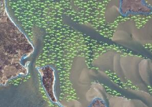
Eelgrass (Zostera marina) is the predominant seagrass, or Submerged Aquatic Vegetation (SAV) species, found in Massachusetts. Seagrasses are distinguished from algae (also called seaweed) which are not classified as plants by biologists (rather they are often placed in the kingdom protista), and distinguishes them from the "emergent" saltwater plants found in salt marshes. The other species of seagrass found in the embayments of the Massachusetts coast is Ruppia maritima, commonly called “widgeon grass,” which is present in areas of lower salinity along Cape Cod and Buzzards Bay. Widgeon grass, found in the upper reaches of embayments, has a thread-like morphology that makes it difficult to identify using remotely sensed data. It can only be identified and located by on-site survey.
Both eelgrass and widgeon grass serve as important fish and wildlife habitat and assist with storage and recycling of nutrients and the stabilization of sediments. The Massachusetts Department of Environmental Protection (MassDEP) began surveying eelgrass in the early 1990s and the MassDEP Eelgrass Mapping Project has produced multiple phases of eelgrass mapping along the Massachusetts coastline.
Throughout the implementation of this program, MassDEP has continued to adopt and utilize "state of the art" methods to ensure the scientific credibility and practical application of the SAV mapping and monitoring data collected. The MassDEP Eelgrass Mapping Project ranks among the longest sustained seagrass monitoring programs (utilizing the same methods) in the world. The program uses remote sensing to acquire data on seagrass extent and monitor the status and trends of the resource statewide. This general approach is comparable to other large scale seagrass monitoring programs in the Chesapeake Bay, Virginia and the Indian River Lagoon in Florida.
During the period 1995-2000, the program utilized high resolution aerial photography captured on Kodak 2448 true color film, with strict requirements for the source data layer. The photos were viewed using 10x magnification and the eelgrass polygon data were drafted to pin-registered acetate overlays. The overlays were then scanned at a high resolution and geo-registered to the Massachusetts orthophoto map series for digital distribution.
In recent years DEP has utilized high resolution digital imagery (0.25m pixel) as the source data. This later method used on-screen digitizing functions available in ESRI's ArcMap and ArcGIS Pro. The remotely sensed data are supplemented by boat-based underwater video data collection and ground truthing to verify benthic habitat signatures. In 2023 Mass DEP began a pilot project to investigate the utility of Object Based Image Analysis geospatial tools including Trimble eCognition software as a tool in the delineation method.
MassDEP Eelgrass Mapping Layers
>> View these layers online to see growth or decline in many areas.
The MassDEP Eelgrass Mapping Project has produced multiple mapping layers of eelgrass distribution along the Massachusetts coastline. The table below shows the areas covered by each mapping phase and associated years. Click on the Project Year below for data documentation and download of individual MassDEP eelgrass layers.
| Phase | Project Years | Project Area |
|---|---|---|
| 1 | 1995 | Entire MA Coast |
| 2 | 2001 | Coast-wide MA Coast except Elizabeth Islands (Gosnold) and Mount Hope Bay |
| 3 | 2006/07 | Selected embayments, coast-wide including Elizabeth Islands |
| 4 | 2010-2013 | 2010 - South Shore of Cape Cod: Woods Hole to Chatham, selected embayments, Pleasant Bay; 2012 - North Shore, Boston Harbor, South Shore to Provincetown; 2013 - Buzzards Bay, Elizabeth Islands, Martha's Vineyard and Nantucket |
| 5 | 2015-2017 | 2015 - South Shore of Cape Cod, Pleasant Bay, Nantucket; 2016 - North Shore, Boston Harbor, South Shore to Canal; 2017 - Buzzards Bay, North Shore of Cape Cod, Elizabeth Islands and Martha's Vineyard |
| 6 | 2019-2023 | 2019 - South Shore of Cape Cod, Pleasant Bay, North Shore of Nantucket 2020 - Martha’s Vineyard, Buzzards Bay and Elizabeth Islands 2021 - Cape Cod Bay (Provincetown through Duxbury) 2022 - South Shore, Boston Harbor, North Shore (Marshfield through Rockport) 2023 - Cape Ann to the New Hampshire border (Essex through Newburyport) |
For additional information, visit the MassDEP Eelgrass Mapping Project or email DEP Wetlands at Dep.Wetlands@mass.gov.