Downloads
Overview
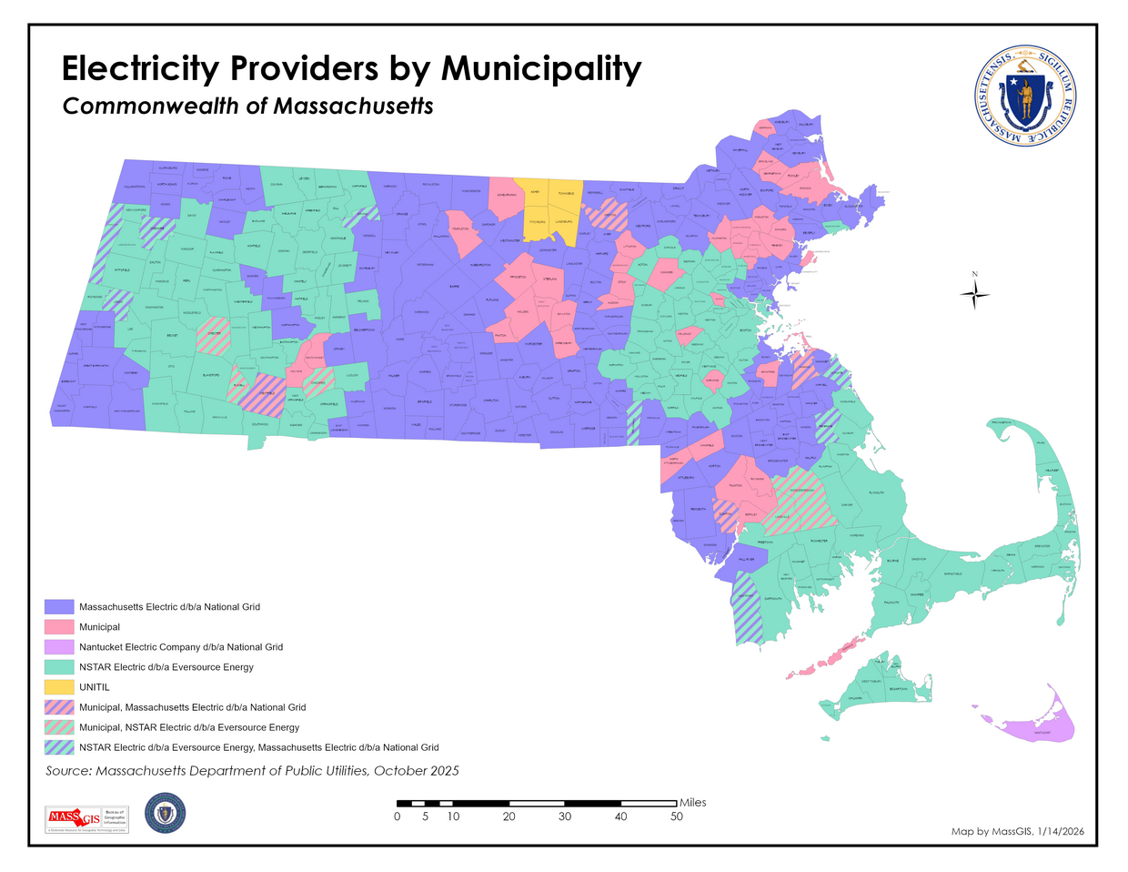
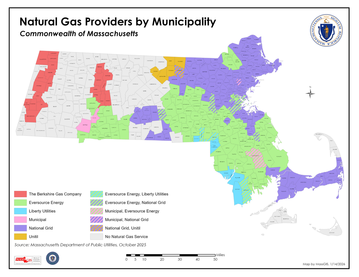
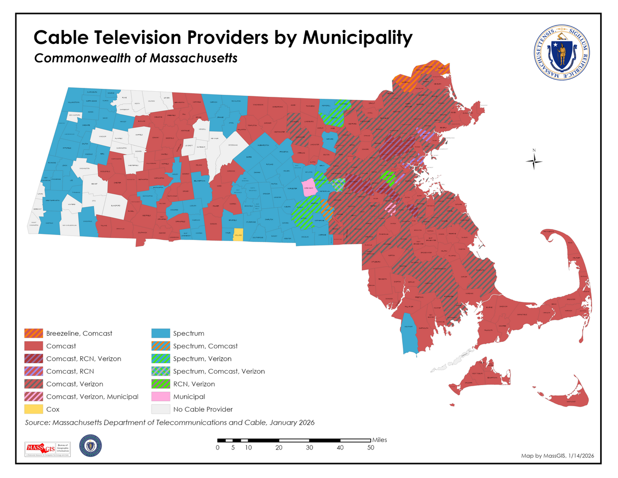
This table contains the public Electric, Natural Gas, and Cable Television utility providers for each Massachusetts municipality. The source of data for Electric and Natural Gas was the Massachusetts Department of Public Utilities, October 2025. The source of data for Cable utilities was the Massachusetts Department of Telecommunications and Cable, January 2026. In addition, a field also stores information on whether a community provides its own Internet service (source: Northeast Public Power Association and individual websites, October 2025 to January 2026).
The table is stored as TOWNS_POLY_UTILITIES and may be joined to any Municipalities layer on the TOWN_ID column. In MassGIS' ArcSDE database, three spatial views have been created that join this table to town polygons: TOWNS_POLY_V_CABLE, TOWNS_POLY_V_ELEC and TOWNS_POLY_V_GAS.
These themes are available in MassMapper and the MassGIS Data Viewer from the menu choices:
CATEGORY: Infrastructure > SUBCATEGORY: Public Utility Providers
View PDF Map of MA electricity providers
View PDF Map of MA Natural Gas Providers
View PDF Map of MA Cable Providers
Attributes
The TOWNS_POLY_UTILITIES table has the following fields:
| Field Name | Description |
|---|---|
| TOWN_ID | 3-digit municipality identifier (1-351) |
| TOWN | Official municipality name |
| ELEC | Electric service provider |
| GAS | Natural Gas service provider |
| CABLE | Cable service provider |
| INTERNET | Indicates (with "Y") if a municipality provides its own Internet service |
| ELEC_LABEL | Modified label for electricity provider for map legends. The text "Municipal" is used instead of the community's power company (which is stored in the ELEC field). |
| GAS_LABEL | Modified label for natural gas provider for map legends. The text "Municipal" is used instead of the community's power company (which is stored in the GAS field). |
| CABL_LABEL | Modified label for cable TV provider for map legends. The text "Municipal" is used instead of the community's cable company (which is stored in the CABLE field). |
Maintenance
MassGIS will maintain the data and update as needed.
| Last updated: | January 14, 2026 |
|---|


