Downloads
Overview

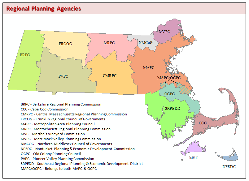
This datalayer represents the boundaries of the 13 regional planning agencies (RPAs) in Massachusetts. Each RPA serves as a forum for state and local officials to address issues of regional importance, including the development of comprehensive plans and recommendations in areas of population and employment, transportation, economic development, regional growth and the environment. The layer was created in ARC/INFO based on the Municipalities layer and lists from each RPA of its member communities.
In ArcSDE the polygon layer is named RPAS_POLY. A line layer of the boundaries was created from the polygon features and is named RPAS_ARC. An ArcSDE annotation class, RPAS_ANNO_RPA, was created using an acronym of the RPA name.
The polygon feature class was updated in August 2021 to be based on the Survey Towns Boundaries (previously based on the USGS-based town boundaries).
Attributes
The polygon attribute table contains the fields RPA_ID (unique ID for each region), RPA_NAME (name of the RPA), and ACRONYM as follows:
| RPA_ID | RPA_NAME | ACRONYM |
|---|---|---|
| 1 | BERKSHIRE REGIONAL PLANNING COMMISSION | BRPC |
| 2 | FRANKLIN REGIONAL COUNCIL OF GOVERNMENTS | FRCOG |
| 3 | PIONEER VALLEY PLANNING COMMISSION | PVPC |
| 4 | MONTACHUSETT REGIONAL PLANNING COMMISSION | MRPC |
| 5 | CENTRAL MASSACHUSETTS REGIONAL PLANNING COMMISSION | CMRPC |
| 6 | NORTHERN MIDDLESEX COUNCIL OF GOVERNMENTS | NMCOG |
| 7 | MERRIMACK VALLEY PLANNING COMMISSION | MVPC |
| 8 | METROPOLITAN AREA PLANNING COUNCIL | MAPC |
| 9 | OLD COLONY PLANNING COUNCIL | OCPC |
| 10 | SOUTHEAST REGIONAL PLANNING & ECONOMIC DEVELOPMENT DISTRICT | SRPEDD |
| 11 | CAPE COD COMMISSION | CCC |
| 12 | MARTHA'S VINEYARD COMMISSION | MVC |
| 13 | NANTUCKET PLANNING & ECONOMIC DEVELOPMENT COMMISSION | NPEDC |
| 14 | BELONGS BOTH TO MAPC & OCPC | MAPC/OCPC |
Also included is the field WEBSITE, which stores the web address (URL) of each RPA.
The RPAS_ARC layer contains the OUTLINE field, coded as follows:
1 = State boundary
2 = Internal RPA boundaries
4 = Coastline
Maintenance
MassGIS maintains this layer. The RPA_NAMEs of the Berkshire and Franklin RPAs were edited to reflect the correct names in December 2004. In December, 2007, the ACRONYM and WEBSITE attributes were added, and the features were edited to form multi-part polygons. In February 2016 the MAPC/OCPC region was edited to include Duxbury and Hanover, which have become members of both RPAs.
Updated in April 2022 to reflect recent edits to the Municipalities layers.