Downloads
Overview

This raster layer, useful for cartographic display, represents a shaded relief or "hillshade" for the surface terrain of Massachusetts. Its source data were the digital terrain models that were produced as part of the 1990s Aerial Imagery project. Cell size is 10 meters by 10 meters. Each cell has a grayscale value ranging from 1 to 255. For details on the terrain model used as a source for this layer and its accuracy standards, see the DTM Files datalayer page.
The image name is IMG_SHDREL5K.
Production
Using ESRI's ArcInfo Workstation software, MassGIS ran the TOPOGRID command, using the existing 3-Meter Elevation Contours (1:5000) layer as input. Working on an Orthophoto Quad Index tile-by-tile basis (clipping the contours out of SDE with a bit of overlap on all sides of the tile), TOPOGRID produced elevation grids based on the contours. The HILLSHADE command then produced the shaded relief grid from the output of TOPOGRID. The hillshade grids were produced with an azimuth of 315 degrees, an altitude of 45 degrees, a Z factor of 1.5, and without the effects of local shadows. To produce a continuous coastline, the outermost breaklines from the Topographic Breaklines layer were appended and edited into polygon coverages, converted to grids, and used the in the SELECTMASK () Grid function. This process allowed all off-shore areas to be coded as NODATA. For some tiles along the coast, there were too few contours to use TOPOGRID. For these, an OQ tile-based area was clipped out of the Digital Elevation Model (1:5,000) and HILLSHADE was run on that. Once grids for all tiles were completed, they were merged into one statewide grid. At this point, any grayscale values of 255 (pure white) within the land portion of the image were changed to 254 and all NODATA was converted to 255 so that when the grid was converted to a tiff image (needed for production of a MrSID image version of the layer), the only 255s would be offshore or in adjacent states, allowing for a white background around valid hillshade data. The grid version was loaded into SDE, after which pyramids were built and statistics generated.
After some experimentation, the TOPOGRID-HILLSHADE approach was chosen over other methods (such as the Surface Analysis > Hillshade tool in ArcGIS' Spatial Analysis extension) because the HILLSHADE command produced the smoothest, most realistic and cartographically pleasing shaded relief image when generated from the already generalized contours, with minimal banding, blockiness, or other visually disturbing artifacts. In a few areas, some banding may be noticeable at large scales, a result of the irregular pattern of original sampling points in the source DTM files.
Attributes
Each cell (pixel) contains a grayscale value ranging from 1 to 255. There are no additional attributes stored in the layer.
Distribution and Display
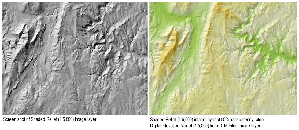
MassGIS distributes this layer in the MrSID image format. Download it from the link near the top of this page. The MrSID image was produced with the lossless compression option in order to preserve the original grid pixel values, particularly the background offshore and out-of-state 255s, which may, in some mapping software, be displayed without any color, so as not to obscure other map layers. Included in the download is a custom ArcGIS 9.0 layer file that displays the shaded relief image with 50% transparency, Bilinear on-screen resampling, and a standard deviation stretch (as shown atop the elevation layer in the sample image). The transparency allows for display with the Digital Elevation Model (1:5,000) grid layer.
Maintenance
MassGIS maintains this layer. No updates are planned.However, a Lidar derived product is scheduled for release in 2021.
For related datalayers see:
- Digital Terrain Model (DTM) Files
- Digital Elevation Model (1:5,000)
- Elevation Contours (1:5,000)
- Topographic Breaklines
- Elevation Points
Also see newer, higher quality Elevation (Topographic) Data from 2005.