Downloads
(447 MB)
(.zip file with integer GRID data and ArcGIS 10.0 layer file)
Overview
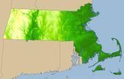
This raster layer represents surface elevation for Massachusetts. It was created from the digital terrain models that were produced as part of the 1990s Aerial Imagery project. Cell size is 5 meters by 5 meters. Each cell has a value, in meters, which represents its elevation above or below sea level and range from 1064.369 to -60.08. For details on the terrain model used as a source for this layer and its accuracy standards, see the DTM files datalayer page.
MassGIS stores two seamless, statewide versions:
- IMG_ELEV5K - floating-point elevation values, to a maximum four decimal places
- IMG_ELEV5K_I - integer elevation values; MassGIS distributes this version in ESRI Grid format (see "Distribution and Display" below).
Production
MassGIS used ESRI's ArcInfo Workstation software to produce TINs (triangulated irregular networks) from each DTM file (based on the Orthophoto Quad index) using the CREATETIN command. Breakline and mass points as coded in the DTMs were incorporated into the TINs. Lattices -- raster surface models with a regular array of cells -- were created from the TINs with the TINLATTICE command. To produce a continuous coastline, the outermost breaklines from the Topographic Breaklines layer were appended and edited into polygon coverages, converted to Grids, and used the in the SELECTMASK () Grid function. This process allowed all off-shore areas to be coded as NODATA. The lattices were then merged into statewide datasets and imported into an ArcSDE raster dataset.
The integer version of the final layer was produced from the floating point raster by adding 0.5 to each pixel's elevation and then truncating each floating point value with the Grid function INT (). This method served to round the floating point values to the closest integer.
Attributes
Each cell (pixel) contains an elevation value, in meters. Negative values represent elevations below sea level based on the NAVD88 vertical datum. There are no additional attributes stored in the layer.
Distribution and Display
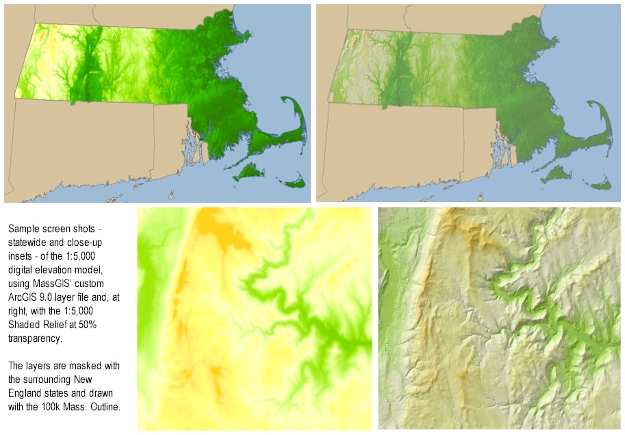
MassGIS distributes the integer-based version of the elevation model in ESRI Grid format via the link at the top of this page with the Shaded Relief (1:5,000) image layer.
Included in the .zip file is a custom ArcGIS 10.0 layer file that produces the green-to-yellow-orange effect seen in the image in the "Overview" section of this page, above. This layer file applies a 3.5 standard deviation stretch to the image and combines several algorithmic color ramps. The goal was to have only the highest elevations in the state symbolized with the orange shading and to avoid the "whitecap" phenomenon used in traditional elevation shading that is more appropriate for truly mountainous areas. When displaying the elevation layer with the shaded relief to achieve the hillshade effect, whichever layer draws last should be semi-transparent. In the sample image on this page, MassGIS uses a transparency of 50% on the shaded relief.
Maintenance
MassGIS maintains this layer. No updates are planned.
NOTE: For more recent data, MassGIS also distributes elevation data from 2005 and LiDAR.Terrain Data.
For related datalayers see: