Where to fish in fresh water
Use the web maps and resources below to find your next fishing spot.
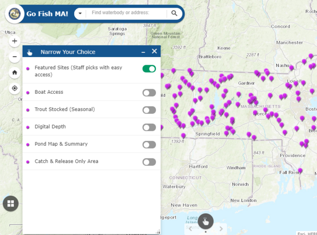
Go Fish MA!
Plan your next fishing trip with MassWildlife's Go Fish MA! interactive map. Find boat ramps, trout stocked waters, pond and lake summaries, and digital depth information—plus over 100 featured fishing sites that offer easy access to great fishing. Launch map now!
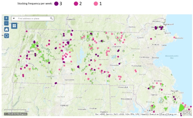
Trout stocking report
MassWildlife stocks trout in lakes, ponds, and rivers every spring and fall. The trout stocking report is updated daily during that time. Search for a waterbody or town using the sortable list, or search the map for new fishing spots. Go to Mass.gov/Trout to see where the trout are!
More tools for more great fishing
Where to fish in salt water
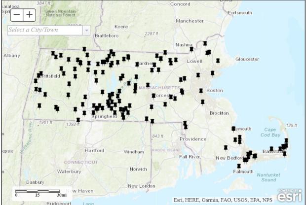
Boat ramps, piers, and shore-side fishing areas
With more than 1,500 miles of coastline, Massachusetts offers a variety of places to fish. This OFBA Boat Ramp Viewer lists boat launches, boat ramps, fishing piers, and shore-side fishing areas in both saltwater and freshwater. All anglers should know their public access rights along the shoreline.
Artificial reefs
Get information and view maps of artificial reef locations.
Fishing charters and headboats
Visit the Massachusetts Recreational Saltwater Fishing Guide for a directory of for-hire vessels.
Where to hunt
Use the links below to help understand your options for hunting on different types of properties. With some research at home and outdoor scouting time, you can find a spot that’s perfect for you!
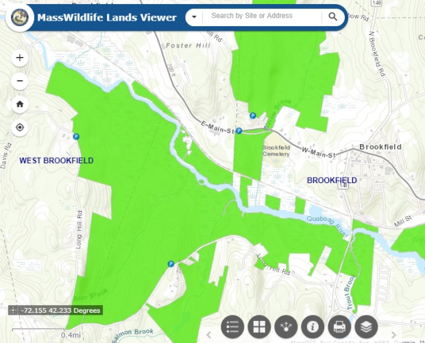
Explore WMAs
Use the MassWildlife Lands Viewer to get digital maps of Wildlife Management Areas across Massachusetts. You can toggle to a satellite view or find your location in real time as you walk a property. WMA property boundaries are updated throughout the year as new lands are acquired. Open Lands Viewer now.
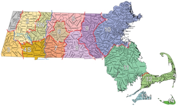
Wildlife Management Zones
MassWildlife manages wildlife using Wildlife Management Zones (WMZ). Some hunting regulations are different depending on which zone you are hunting in. Antlerless deer permits are allocated by WMZ. See zone map now.
Pheasant stocking locations
Every year, MassWildlife stocks about 40,000 ring-necked pheasants statewide on many Wildlife Management Areas and other lands that are open to hunting. Go to Mass.gov/Pheasant to see where stocking happens.
Click the link above for a complete listing of where-to-hunt resources, including hunting in state parks, municipal and federal lands, and private property.