- This page, Connecticut River Greenway State Park, is offered by
- Department of Conservation & Recreation
- Universal Access Program
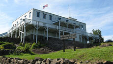
Connecticut River Greenway State Park

Details
Overview
The Connecticut River Greenway connects parks and other areas along the Connecticut River. Up to 8 parks are accessible from the greenway as you follow it across the state. You'll find river access with public boat ramps all along the river.
Hours
Sunrise to sunset
Parking
Parking is available at park headquarters and public boat ramps along the greenway.
Activities
-
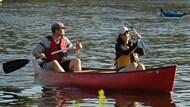
Canoeing & kayaking
Take an easy ride down the Connecticut River and enjoy the views.
All Activities
- Boating (motorized)
- Boating (non-motorized)
- Cross-country skiing
- Educational programs
- Hiking
- Fishing
- Hunting
Facilities
- Boat ramp
- Picnic area
- Restrooms
- Scenic viewing area
Accessibility
- Accessible boating
- Accessible restrooms
More info
River access points
- Pauchaug, Northfield
- 1 mile north of Northfield Center on Rte. 63
- Paved parking area and ramp
- Canoes, fishing boats, and recreational motorboats
- 1 mile north of Northfield Center on Rte. 63
- Barton Cove, Gill
- 1.5 miles east of Turner’s Falls on Rte 2
- Paved parking area and ramp
- Recreational motorboats, canoes, and fishing boats
- 1.5 miles east of Turner’s Falls on Rte 2
- Sunderland
- At the end of School Street on the north side of Sunderland Bridge.
- Limited parking
- At the end of School Street on the north side of Sunderland Bridge.
- Hatfield
- 1 mile north of Hatfield Center
- Shallow draft lightweight boats and canoes
- 1 mile north of Hatfield Center
- Elwell Recreation Area, Northampton
- Damon Road at Route 9 and I-91
- Canoes and rowing access only
- Wheelchair accessible dock
- Limited parking
- Damon Road at Route 9 and I-91
- Oxbow Ramp, Easthampton
- Take Rte. I-91 to exit 18 south on Rte. 5 before the Manhan Rail Trail
- High-powered recreational boats and larger fishing boats
- 35 parking spaces and paved ramp
- Take Rte. I-91 to exit 18 south on Rte. 5 before the Manhan Rail Trail
- South Hadley/Chicopee
- James Street at the South Hadley/Chicopee town line downstream from the Holyoke Dam
- 6-8 parking spaces and gravel ramp
- Shallow draft fishing boats
- James Street at the South Hadley/Chicopee town line downstream from the Holyoke Dam
- Chicopee
- 1 half mile off Rte. 116 on Melina Street
- 32 parking spaces and paved ramp
- Shallow, moderate, and deep draft recreational and fishing boats
- Easy canoe and rowing shell access.
- 1 half mile off Rte. 116 on Melina Street
Image credits:
CRGSP/Kindra Clinneff