Location listing filters
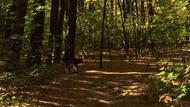
Map for Franklin State Forest
Note for screen reader users, we suggest skip the following interactive map and go to the location listing for a better user experience.
Currently, the map is not accessible yet for a comprehensive experience.
skip to the location listing
Location Listing
Showing 1 - 3 of 3 results for Other locations related to Franklin State Forest
-

F. Gilbert Hills State Forest
45 Mill Street, Foxborough, MA 02035 DirectionsF. Gilbert Hills is a 1000-acre state forest that offers 23 miles of trails through pine and oak. You can hike, mountain bike, and horseback ride, among other activities. The park is also part of the 30-mile Warner Trail that stretches from Sharon, Mass to Diamond Hill State park in Rhode Island. There are also 8 miles of motor biking trails.
The OHV trail is accessed on High Rock Road, which is off of Route 1 North immediately before Motorcycles of Manchester. Approximate address is 100 High Rock Road.Phone(508) 543-9084 -

Southern New England Trunkline Trail
107 Wallum Lake Road, Douglas, MA 01516 DirectionsThe Southern New England Trunkline Trail runs 22 miles from Douglas State Forest to Franklin State Forest. The trail is one of the longest trails in Massachusetts, running through 6 towns. You can find marked trail entrances at each of these towns. The trail is popular to bicyclists, cross-country skiers, equestrians, and hikers.Phone(508) 476-7872-
Sunrise to sunset
-
-
Wrentham State Forest
690 Taunton St, Wrentham, MA 02093 DirectionsCovering over 1,000 acres, Wrentham State Forest is a minimally developed area. The gravel parking area on Taunton Street leads to miles of weaving trails and dirt roads. Trails are open for hiking, mountain biking, and cross-country skiing. Additionally there is a designated loop trail for off-roading. Motorized use at this forest is restricted to Motorcycles only. The park also offers access to the Warner Trail, a 30-mile hiking trail that travels through Norfolk County down to Rhode Island.Phone(508) 543-9084