Location listing filters
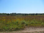
Map for Waquoit Bay National Estuarine Research Reserve
Note for screen reader users, we suggest skip the following interactive map and go to the location listing for a better user experience.
Currently, the map is not accessible yet for a comprehensive experience.
skip to the location listing
Location Listing
Showing 1 - 3 of 3 results for Other locations related to Waquoit Bay National Estuarine Research Reserve
-

Cape Cod Rail Trail
- Wheelchair Accessible
3488 Main St., Brewster, MA 02631 DirectionsRide, walk or run through 6 Cape Cod towns as you follow the Cape Cod Rail Trail. There’s plenty to see along the 25-mile trail and state and national parks to visit as you please.Phone(508) 896-3491-
Sunrise to sunset
-
Manuel F. Correllus State Forest
Barnes Road, Edgartown, MA 02539 DirectionsThis over 5,300 acre forest sits in the center of Martha's Vineyard. You'll find miles of trails, a paved shared-use path, and a disc golf course. At the center of the park, there's a statue honoring the last habitat for the heath hen, a type of grouse that when extinct in 1932.Phone(508) 693-2540-
Sunrise to sunset
-
-

Shawme-Crowell State Forest
- Wheelchair Accessible
42 Main St., Sandwich, MA 02563 DirectionsThis 700-acre pitch pine and scrub oak forest is located on the western end of Cape Cod, and offers more than 15 miles of trails for hiking and horseback riding. Camping is a favorite activity from early summer to the fall.Phone(508) 888-0351-
Dawn to dusk