Downloads
Overview
Evacuation may be necessary during a hurricane or tropical storm due to risk of storm surge. Storm surge is an abnormal rise of water generated by a storm, over and above the predicted astronomical tide. The destructive power of storm surge and large battering waves is often the greatest threat to life and property during a storm, and can result in loss of life, destroyed buildings, beach and dune erosion, and road and bridge damage along the coast.
Hurricane surge elevations were determined by the National Hurricane Center using the PV2 SLOSH model basin, and assumed peak hurricane surge arriving at mean high water. The Evacuation Zones are based on the Hurricane Surge Inundation that can be expected to result from a worst case combination of hurricane landfall location, forward speed and direction for each hurricane category.
Note: The hurricane evacuation zones do not directly correspond to hurricane categories. Storm surge impact is not measured by the Saffir-Simpson hurricane category scale, and storm surge threats can vary from storm to storm.
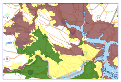
If you live, work, or plan to vacation in one of Massachusetts’ coastal communities, or near a river or other waterway connected to the ocean, you should "Know Your Zone." Use MEMA's interactive map to learn whether your home or business is in a predesignated hurricane evacuation zone. Also see MEMA's website.
The layer is named HURR_EVAC_ZONES_POLY.
Attributes
The ZONE field stores the evacuation zone:
- Zones A & B – These zones include areas that, depending on predicted inundation, may flood first from storm surge during a tropical storm or hurricane. Areas in Zone A would flood before areas in Zone B.
- Zone C – The cities of Boston and Cambridge have designated a third zone, Zone C, which may flood depending on the track and intensity of the storm.
The TOWN field stores the name of the city or town of the zone, as the polygons are split at municipal boundaries.
Maintenance
The Massachusetts Emergency Management Agency (MEMA), the provider of this dataset, will send any updates to MassGIS.
| Date published: | May 22, 2026 |
|---|