Downloads
Overview
The MBTA Communities Atlas is a composite data product that aggregates information from municipally submitted 3A compliance materials and HLC’s compliance review process to create an authoritative dataset about the program’s zoning results. HLC created the dataset to:
- Provide the public with a user-friendly record of 3A districts that incorporates corrections made during the compliance review process.
- Establish ‘baseline’ housing unit counts for each parcel and district in 2022, before most municipalities started rezoning for compliance.
- Make data available as a self-service product to ease the process of accessing public records.
Please note that this data is intended for use in policy analysis, research, and public understanding on zoning in Massachusetts and the MBTA Communities law. In addition, the dataset includes only municipalities and districts which HLC has determined to be compliant with the regulations. HLC cautions that:
- This data is not a legal record of permitted land uses for development purposes. A municipality’s zoning ordinance or bylaw and its zoning map govern land use, and nothing in this dataset should be construed to supersede municipal zoning ordinances, bylaws, or maps.
- The Compliance Determination Letter issued to each municipality is the dispositive record of its compliance with the MBTA Communities law and the multifamily unit capacity determined to be eligible for compliance purposes. In the rare cases where this dataset diverges from the unit numbers documented in compliance determination letters, those discrepancies are documented in the data.
Users are advised to become familiar with the MBTA Communities regulations, the Compliance Model, and data made available to municipalities in order to understand how the municipal submissions were created and what the compliance model does.
MassGIS stores the following three GIS polygon datalayers:
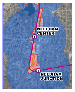
- MBTA3A_DISTRICTS_POLY - Districts located within 0.5 miles of a transit station that allow multi-family housing "by right"
- MBTA3A_PARCELS_POLY - Parcel that are aggregated to form the Districts layer
- MBTA3A_TRANSIT_HALFM_RADII_POLY - Circular half-mile buffers around MBTA transit and Commuter Rail stations
Notes for users
Two particular discrepancy types that arise between comparing the atlas across multiple geographic levels are common to multiple municipalities and warrant further explanation.
- District caps: Within the compliance model, municipalities had the opportunity to specify district-level unit caps in the “Cap on Maximum Dwelling Units per District” field on the Checklist Parameters tab. This field could be used where the municipality has other mechanisms to limit district-wide development to less than what would be expected based on the parcel-level capacity calculations. When the District Cap is in effect, the official “Final Unit Capacity” for the district is set at the cap, rather than the sum of parcel estimates. As of February 2026, HLC has identified fourteen districts across eight municipalities where this cap applies. Users should avoid inferring total capacity at the district or municipal level from a sum of parcel-level capacity in these districts.
- Mandatory Mixed-Use (MMU): HLC’s MBTA Communities regulations (Section 72.05(c) of 760 CMR 72.00: Multi-Family Zoning Requirements for MBTA Communities) allow municipalities to require first-floor commercial uses as a condition of development. However, such a mandatory mixed-use district (termed “mixed-used development district” in the regulations) can satisfy only 25% of a municipality’s unit capacity requirement. Capacity in MMU districts is properly reduced to 25% of the requirement for the purpose of determining municipal-level capacity for compliance, but the data products retain the parcel- and district-level unit capacities as calculated in the compliance model, since this more accurately represents potential development capacity. As of February 2026, there are six municipalities where the MMU capacity exceeded the 25% cap, and users should avoid inferring determined unit capacity for compliance purposes from the atlas in those municipalities.
Production
HLC produced the Atlas from municipally submitted Compliance Models and GIS features. Parcel records were extracted from the Compliance models using an automated process and combined into a single file. GIS shapefiles were standardized or transformed as necessary and then aggregated into a single feature class. Where necessary, HLC modified features for three purposes:
- To correct errors and accurately reflect the district as it was determined to be compliant during HLC’s review process.
- Example changes: Removing parcels from the compliance model that were not within the district as it was represented on the municipality’s zoning map; removing overrides of developable land area that were not accepted, etc.
- Create a one-to-one relationship between Compliance Model tabs and GIS features, as labeling geometries with their attributes is a core purpose of the file and is impossible without such a one-to-one relationship.
- Example changes: Dissolving multiple features representing a single district into multipart polygons by zone code; assigning a unique zone code to each GIS feature and compliance model zoning district.
- Modify the schema of each GIS submission to match the HLC GIS Data Submittal Standards.
- Example changes: Adding the submitting municipality’s name, Muni_ID, or ZoneCode field.
A log of substantive changes by municipality is available in the Changelog section.
As part of this effort, EOHLC also established a baseline housing unit count for each parcel, intended to represent the number of homes existing before any rezoning for MBTA Communities compliance. This value is drawn from Residensity, a data product produced by the Massachusetts Housing Partnership. Since Assessor unit counts are not always present or accurate, Residensity uses information from assessor data (land use code and unit counts) as well as commercial sources to develop a best estimate of existing units on a parcel for each vintage of the assessor data. EOHLC used the June 2022 vintage of Residensity since it most closely matches the vintage used for producing the land maps provided to municipalities for the compliance model. For the small number of parcels (<100) where a June 2022 unit estimate was not available, EOHLC used the October 2022 Residensity vintage. The source of the unit estimate within the Residensity data is included as another field.
Attributes in the spatial data
Districts
The MBTA3A_DISTRICTS_POLY attribute table has the following fields:
| Field Name | Data Type | Description |
|---|---|---|
| ZONECODE | Text | Zone code (concatenated from MUNI_ID and ZONABBR) |
| MUNI_ID | Double | Massachusetts municipality ID |
| MUNI | Text | Municipality |
| ZONENAM | Text | Zone name from data submitted by municipalities. |
| ZONABBR | Text | Zone abbreviation from data submitted by municipalities. |
| DATE_ | Date | Date field from data submitted by municipalities. |
| ISOVRLAY | Double | Overlay status from shapefiles submitted by municipalities. |
| STATUS | Text | Compliance status as of the issue date of the dataset |
| MFUC_PARC | Long | The total calculated unit capacity of this district as represented by compliance model parcel data. Calculated as the sum of the Final.Lot.Multi.family.Unit.Capacity field for each parcel in the district |
| MFUC_DIST | Long | Reported district-level capacity from the summary tab of the compliance model, incorporating any district-level unit capacity caps or other adjustments applied by EOHLC or municipalities. |
| DIFFMFUC | Long | The amount by which the parcel level unit capacity exceeds the district unit capacity after caps and adjustments are applied. Calculated as the difference between MFUC_DIST and MFUC_PARC |
| MFUC_CLN | Long | MFUC_PARC adjusted downward by DIFFMFUC |
| ACRS_CM | Double | District acreage as reported in the compliance model |
| DNDN_CM | Double | District density denominator used for calculating unit capacity for compliance purpose |
| DUAC_CM | Double | Dwelling units per acre as reported in the compliance model |
| PRCA_CM | Double | Parcel acreage as reported in the compliance model |
| DUC_HMB | Long | Unit capacity in the station area in the compliance model |
| OSRQ_PC | Double | Required open space percentage as reported in the compliance model. 0 means no relevant requirement was reported. |
| PRKNPDU | Double | Required parking space per dwelling unit as reported in the compliance model. 0 means no relevant requirement was reported. |
| STORIES | Double | Maximum building height in stories as reported in the compliance model. 0 means no relevant requirement was reported. |
| LOTCOV | Double | Maximum lot coverage percentage as reported in the compliance model. 0 means no relevant requirement was reported. |
| FAR | Double | Maximum floor area ratio as reported in the compliance model. 0 means no relevant requirement was reported. |
| AREAPDU | Long | Required lot area per dwelling unit as reported in the compliance model. 0 means no relevant requirement was reported. |
| MXDUPAC | Double | Maximum dwelling units per acre as reported in the compliance model. 0 means no relevant requirement was reported. |
| DU_CAP | Long | Cap on maximum dwelling units per district as reported in the compliance model. 0 means no relevant requirement was reported. |
| NOTES | Text | Description of the source of the discrepancy if the GR_FCMD and GR_FCMP fields do not match |
Parcels
The MBTA3A_PARCELS_POLY layer includes fields from two sources. Those from MHP’s Residensity data product each have the prefix “RB_” denoting that the field derives from the Residensity baseline. All else is derived from parcel-level information submitted in municipalities’ compliance worksheets. The MBTA3A_PARCELS_POLY attribute table has the following fields:
Fields from Residensity
| Field Name | Data Type | Description |
|---|---|---|
| LOC_ID | Text | LOC_ID for use in joining to the parcel-level atlas. |
| RB_LAST | Long | Date of last edit |
| RB_STAD | Text | Site address |
| RB_ASSY | Long | Assessed year |
| RB_ACRG | Double | Parcel acreage |
| RB_STUC | Text | Standardized land use code |
| RB_USDS | Text | Standardized use description |
| RB_NnRU | Text | Non-residential uses |
| RB_ASUD | Text | Use description |
| RB_RSDN | Double | Residential units |
| RB_NTSR | Text | Source of residential units count |
| RB_DUA | Double | Dwelling units per acre |
| RB_DVLP | Text | MHP-estimated developability |
Fields from compliance models
| Field Name | Associated field in tabular atlas | Data Type | Description |
|---|---|---|---|
| MUNI | Muni | Text | Municipality |
| ADDRESS | Address | Text | Parcel address as entered in compliance model |
| OWNER | Owner | Text | Parcel owner as entered in compliance model |
| EXS_U_C | Existing.Use.Codes | Text | Existing use codes as entered in compliance model |
| EXS_U_D | Existing.Use.Description | Text | Existing use description as entered in compliance model |
| TRNSTST | TransitStation | Text | Indicates if the parcel is within the ½ mile buffer of a transit station; this determination is made by EOHLC in the parcel data provided to municipalities. Y = Yes, N = No. |
| PRCLACR | ParcelAcres | Double | Parcel area in acres as entered in compliance model |
| PRCL_SF | Parcel.sf | Double | Parcel area in square feet as entered in compliance model |
| EXCLD_P | Excluded.Public | Double | Public land excluded as entered in compliance model |
| EXCLD_NP | Excluded.NonPublic | Double | Non-public land excluded as entered in compliance model |
| TTL_E_L | Total.Excluded.Land | Double | Total land excluded as entered in compliance model |
| TTL_S_L | Total.Sensitive.Land | Text | Sensitive land as entered in compliance model |
| DVLP_P_ | Developable.Parcel.sf | Double | Developable parcel area in square feet as tabulated in compliance model |
| OVRR_D_ | Override.Developable.sf | Double | Manual override of developable parcel square feet entered in compliance model, if applicable |
| OVRRD_N | Override.Note | Text | Note explaining justification for override, if applicable |
| D_SF__U | Developable.SF.for.Unit.Calc | Double | Final developable parcel area in square feet, incorporating any overrides |
| EXC_L__ | Excluded.Land.. | Double | Percent of land being excluded |
| OPN_S__ | Open.Space.. | Double | Open space requirement percentage as reported in compliance model |
| OPN_S_R | Open.Space.Removed | Text | Open space removed via open space requirement in square feet |
| PRK_A_R | Parking.Area.Removed | Double | Parking area removed as tabulated in compliance model |
| BLDNG_F | Building.Footprint | Double | Tabulated potential footprint after accounting for these requirements |
| BLDNG_E | Building.Envelope | Double | Tabulated potential building envelope based on height limit and footprint |
| MDL_U_C | Modeled.Unit.Capacity | Long | Unit capacity based on building envelope assuming 1000 square feet per unit |
| D_U__A_ | Dwelling.Units.per.Acre.Limit | Double | Cap on dwelling units on the parcel based on dwelling units per acre limit |
| M_L_C_L | Max.Lot.Coverage.Limit | Double | Cap on dwelling units on the parcel based on max lot coverage limit |
| L_A__D_ | Lot.Area.per.Dwelling. Unit.Limit | Double | Cap on dwelling units on the parcel based on lot area per dwelling unit limit |
| FAR_LMT | FAR.Limit | Double | Cap on dwelling units on the parcel based on FAR requirements |
| M_U__L_ | Max.Units.per.Lot.Limit | Long | Cap on dwelling units on the parcel based on max units per lot |
| NN_CN__ | Non.Conforming.lot. | Text | Indicator of whether the lot is non-conforming |
| M______ | Max.units.based.on.addt.l.lot.size.requirements | Text | Cap on dwelling units on the parcel based on any additional lot size requirements |
| F_L_M__ | Final.Lot.Multi.family.Unit.Capacity | Long | Final modeled unit capacity for compliance purposes after imposing all other caps (the minimum of all other fields) |
| DU_P_AC | DU.per.AC | Double | Final dwelling units per acre as tabulated in the compliance model for compliance purposes |
| ZONECOD | ZoneCode | Text | Zone Code for use in joining to the district-level GIS file |
| MUNIID | MuniID | Long | Massachusetts municipality ID |
| STATUS | Status | Text | Compliance status as of the issue date of the dataset |
Transit Radii
The MBTA3A_TRANSIT_HALFM_RADII_POLY attribute table has no added fields.
Attributes in the downloadable tabular atlas Excel file
Columns in the Municipality tab
| Field | Description |
|---|---|
| Municipality | Municipality |
| MuniID | Massachusetts municipality ID |
| Status | Compliance status as of the issue date of the dataset |
| TransitCat | MBTA Communities Transit Category of the municipality |
| MinMFUC | Minimum multi-family unit capacity for the municipality, as determined by the implementing regulations |
| 2020HU | 2020 housing units in the municipality |
| MFUC | The total calculated unit capacity of the districts submitted to EOHLC to demonstrate compliance with the regulations. Calculated by summing the CleanedMFUC field from each District, for each municipality. |
| Letter_LandArea_Req | Required land area based on compliance determination letters |
| Letter_LandArea_Sub | Submitted land area based on compliance determination letters |
| Letter_LandArea_Det | Determined land area based on compliance determination letters |
| Letter_UnitCapacity_Sub | Submitted unit capacity based on compliance determination letters |
| Letter_UnitCapacity_Det | Determined unit capacity based on compliance determination letters. This can vary from the MFUC field for reasons explained in the Notes. |
| Letter_Recipient | Recipient of the compliance determination letter |
| Letter_DateSent_Month | Month the compliance determination letter was sent |
| Letter_DateSent_Day | Day the compliance determination letter was sent |
| Letter_DateSent_Year | Year the compliance determination letter was sent |
| MatchStatus | Description of whether the MFUC field above matches the Letter_UnitCapacity_Sub field, the Letter_UnitCapacity_Det, both, or neither |
| Notes | Description of the source of the discrepancy if the MFUC field does not match the UnitCapacity_Det field |
| HLC Changes | Description of steps HLC took to transform, edit, or create data for districts and parcels when data submitted by municipalities was incorrect or inconsistent. |
Columns in the District tab
| Field | Description |
|---|---|
| ZoneCode | ZoneCode for use in joining to the district-level GIS file. This is a concatenation of the MuniID with the zoning district abbreviation |
| MuniID | Massachusetts municipality ID |
| MFUC_FromCMParcels | The total calculated unit capacity of this district as represented by compliance model parcel data. Calculated as the sum of the Final.Lot.Multi.family.Unit.Capacity field for each parcel in the district |
| DistrictName | Name of the district as reported in the compliance model |
| MFUC_FromCMDistricts | Reported district-level capacity from the summary tab of the compliance model, incorporating any district-level unit capacity caps or other adjustments applied by EOHLC or municipalities. |
| Municipality | Municipality |
| Status | Compliance status as of the issue date of the dataset |
| DiffMFUC | The amount by which the parcel level unit capacity exceeds the district unit capacity after caps and adjustments are applied. Calculated as the difference between MFUC_FromCMDistricts and MFUC_FromCMParcels |
| CleanedMFUC | MFUC_FromCMParcels adjusted downward by DiffMFUC |
| Acres_CM | District acreage as reported in the compliance model |
| DenDen_CM | District density denominator used for calculating unit capacity for compliance purpose |
| DUpAC_CM | Dwelling units per acre as reported in the compliance model |
| ParcAc_CM | Parcel acreage as reported in the compliance model |
| DUcap_HMB | Unit capacity in the station area in the compliance model |
| OSreq_pct | Required open space percentage as reported in the compliance model. 0 means no relevant requirement was reported. |
| ParkingPDU | Required parking space per dwelling unit as reported in the compliance model. 0 means no relevant requirement was reported. |
| Stories | Maximum building height in stories as reported in the compliance model. 0 means no relevant requirement was reported. |
| LotCov | Maximum lot coverage percentage as reported in the compliance model. 0 means no relevant requirement was reported. |
| FAR | Maximum floor area ratio as reported in the compliance model. 0 means no relevant requirement was reported. |
| AreapDU | Required lot area per dwelling unit as reported in the compliance model. 0 means no relevant requirement was reported. |
| MaxDUpAc | Maximum dwelling units per acre as reported in the compliance model. 0 means no relevant requirement was reported. |
| DU_Cap | Cap on maximum dwelling units per district as reported in the compliance model. 0 means no relevant requirement was reported. |
| Notes | Description of the source of the discrepancy if the MFUC_FromCMDistricts and MFUC_FromCMParcels fields do not match |
Columns in the Parcel tab
| Field | Description |
|---|---|
| Muni | Massachusetts municipality ID |
| LOC_ID | LOC_ID for use in joining to the Composite Residensity Baseline GIS file |
| Address | Parcel address as entered in compliance model |
| Owner | Parcel owner as entered in compliance model |
| Existing.Use.Codes | Existing use codes as entered in compliance model |
| Existing.Use.Description | Existing use description as entered in compliance model |
| TransitStation | Indicates if the parcel is within the ½ mile buffer of a transit station; this determination is made by EOHLC in the parcel data provided to municipalities. |
| ParcelAcres | Parcel area in acres as entered in compliance model |
| Parcel.sf | Parcel area in square feet as entered in compliance model |
| Excluded.Public | Public land excluded as entered in compliance model |
| Excluded.NonPublic | Non-public land excluded as entered in compliance model |
| Total.Excluded.Land | Total land excluded as entered in compliance model |
| Total.Sensitive.Land | Sensitive land as entered in compliance model |
| Developable.Parcel.sf | Developable parcel area in square feet as tabulated in compliance model |
| Override.Developable.sf | Manual override of developable parcel square feet entered in compliance model, if applicable |
| Override.Note | Note explaining justification for override, if applicable |
| Developable.SF.for.Unit.Calc | Final developable parcel area in square feet, incorporating any overrides |
| Excluded.Land.. | Percent of land being excluded |
| Open.Space.. | Open space requirement percentage as reported in compliance model |
| Open.Space.Removed | Open space removed via open space requirement in square feet |
| Parking.Area.Removed | Parking area removed as tabulated in compliance model |
| Building.Footprint | Tabulated potential footprint after accounting for these requirements |
| Building.Envelope | Tabulated potential building envelope based on height limit and footprint |
| Modeled.Unit.Capacity | Unit capacity based on building envelope assuming 1000 square feet per unit |
| Dwelling.Units.per.Acre.Limit | Cap on dwelling units on the parcel based on dwelling units per acre limit |
| Max.Lot.Coverage.Limit | Cap on dwelling units on the parcel based on max lot coverage limit |
| Lot.Area.per.Dwelling. Unit.Limit | Cap on dwelling units on the parcel based on lot area per dwelling unit limit |
| FAR.Limit | Cap on dwelling units on the parcel based on FAR requirements |
| Max.Units.per.Lot.Limit | Cap on dwelling units on the parcel based on max units per lot |
| Non.Conforming.lot. | Indicator of whether the lot is non-conforming |
| Max.units.based.on. addt.l.lot.size.requirements | Cap on dwelling units on the parcel based on any additional lot size requirements |
| Final.Lot.Multi.family. Unit.Capacity | Final modeled unit capacity for compliance purposes after imposing all other caps (the minimum of all other fields) |
| DU.per.AC | Final dwelling units per acre as tabulated in the compliance model for compliance purposes |
| ZoneCode | ZoneCode for use in joining to the district-level GIS file |
| MuniID | Massachusetts municipality ID |
| Status | Compliance status as of the issue date of the dataset |
| RB_residentialunits | Residensity Baseline residential units as of June 2022 |
| RB_unitsource | Source of unit estimate in Residensity Baseline |
Maintenance
HLC will maintain this dataset by periodically furnishing new vintages to MassGIS. These new vintages will include the following changes:
- Adding records for municipalities that have achieved full compliance.
- Adding new features for municipalities that submit major zoning revisions to HLC after achieving compliance and marking their initial features as superseded.
- Correcting any record-level discrepancies as they arise.
Changelog
HLC changes to municipal submissions before initial posting
A log of substantive changes HLC made to municipally submitted materials before aggregating them into this atlas is reflected in the HLCChanges column of the municipal-level Atlas. These corrections align this data product with the compliance determination letters issued to municipalities.
Changes since initial posting
The July 2026 update includes data for two new compliant communities, Hopkinton and West Bridgewater.
| Date published: | April 20, 2026 |
|---|---|
| Last updated: | July 9, 2026 |