Most popular maps
Massachusetts Interactive Property Map
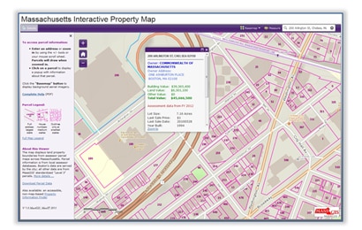
The Massachusetts Interactive Property Map, developed by MassGIS, enables developers, banks, realtors, businesses, and homeowners to view seamless property information such as land valuation and owner across the Commonwealth. Review more details about the Massachusetts Interactive Property Map.
>> Open the Massachusetts Interactive Property Map
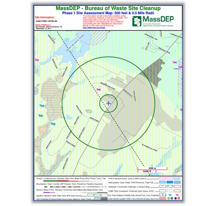
Phase 1 Site Assessment Map
Overview
The purpose of this tool is to allow a Potentially Responsible Party (PRP) or a Licensed Site Professional (LSP) to generate a Phase 1 Site Assessment Map that is suitable for printing on a standard letter ( 7.5” x 11” ) sized portrait page.
Site Information
The name, address, town and RTN information that you provide will be displayed at the top of the map. Address and or town information is also used to zoom the map to the general area of the site. Once the map opens at this initial extent you can use the Map Tools to navigate the map, locate a site and generate an MCP NRS Map. Buffers will be drawn at 500 ft and .5 mile around your site.
>> Get a Phase 1 Site Assessment map
Massachusetts' History of Orthophotos
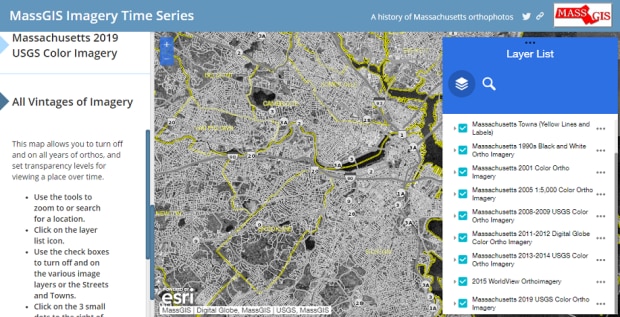
For over 25 years, MassGIS has been paying for or otherwise collecting orthophotography for Massachusetts. While MassGIS does this primarily to create an accurate basemap upon which to build and display other GIS maps, for most of the vintages of orthophotos, the general public can view and download the images. In 2020, we created a story map that explains the ortho imagery acquisition through the years and allows the reader to explore the various vintages in one location.
>> Open the Massachusetts History of Orthophotos story map
Statewide Property Sales Viewer
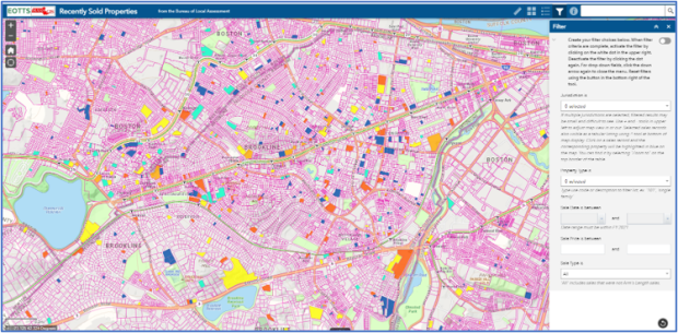
The Statewide Property Sales Viewer maps real estate sales assembled by the State's Bureau of Local Assessment (part of the Division of Local Services). The source is the annual "LA3" sales reports provided by municipal assessors. On the Division of Local Services website, these sales can be searched by property type, range of sale date or price, and other characteristics. You can download the search results. This MassGIS sales viewer application supports the same search criteria and then maps the result, color coding the sales based on their assessment-to-sale ratio. You can also still see and download the tabular result.
>> Go to the Statewide Property Sales Viewer map
Massachusetts Elevation Finder
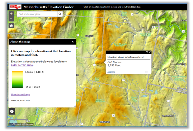
Click anywhere on the map in Massachusetts to view elevation in meters and feet at that location.
These data, derived from Lidar, represent the "bare earth" elevation of the terrain surface without vegetation and artificial features.
Coastal maps
MORIS is the Massachusetts Ocean Resource Information System
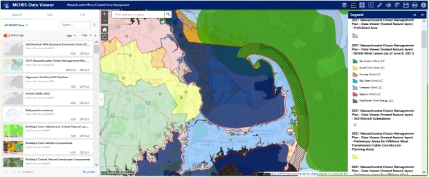
MORIS was created by the Massachusetts Office of Coastal Zone Management (CZM) to provide access
to geospatial data, interactive maps, and tools pertaining to the Massachusetts coastal zone. Users can:
- Create customized maps with a variety of data layers related to the Massachusetts coastal zone and nearshore ocean, including tide gauge stations, marine protected areas, coastal access points, eelgrass beds, Massachusetts Ocean Management Plan data, and many others.
- Share maps and download the data for use in a GIS.
>> Open MORIS
CZM's Sea Level Rise and Coastal Flooding Viewer
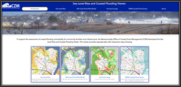
CZM developed the Sea Level Rise and Coastal Flooding Viewer to support the assessment of coastal flooding vulnerability and risk for community facilities and infrastructure, consistent with the Governor's Executive Order 569. This viewer includes interactive maps of flooding extents and water level elevations associated with sea level rise scenarios, current coastal flood zones, and hurricane surge modeled by the National Oceanic and Atmospheric Administration (NOAA), Federal Emergency Management Agency (FEMA), and U.S. Army Corps of Engineers (USACE).
>> Open the CZM Sea Level Rise map
Massachusetts Coastal Erosion Viewer
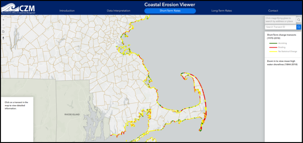
The goal of the Massachusetts Shoreline Change Project and this viewer is to develop and distribute scientific data that supports local land-use decisions regarding coastal property and infrastructure, as well as protection of beaches, dunes, and other coastal resources. This information can be used to help environmental managers, shorefront landowners, consultants, and potential property buyers make informed decisions about coastal erosion. Developed by the Massachusetts Office of Coastal Zone Management (CZM), in collaboration with the U.S. Geological Survey (USGS), the Shoreline Change Viewer provides local data about shoreline movement, including historical positions and rates of erosion and accretion.
>> Open the Massachusetts Coastal Erosion map
CZM Coast Guide Online
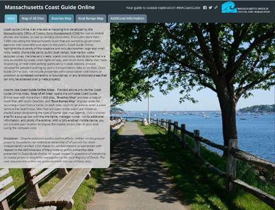
Coast Guide Online is an interactive map developed by CZM for use on mobile phones and tablets, as well as desktop computers. It includes more than 1,900 sites along the Massachusetts coast that are owned by government agencies and nonprofits and open to the public—from long, sandy beaches and rocky shores to small rights-of-way and public landings.
>> Open the CZM Coast Guide map
>> Read more about Coast Guide
MassDEP Eelgrass Mapping Project Viewer
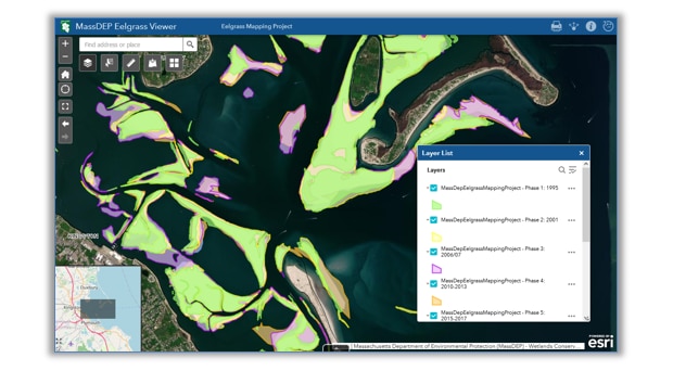
The MassDEP Eelgrass Mapping Project viewer allows the user to select and review the areal extents of mapped eelgrass (Zostera marina) along the coastline of Massachusetts. The user can select from any of the six phases of the MassDEP Eelgrass Mapping Project. MassDEP has conducted surveys using remote sensing since the 1990's. All of the eelgrass map data in this viewer are available for download from MassGIS.
>> Open the MassDEP Eelgrass map
>> Read more about MassDEP's Eelgrass mapping project
NOAA Data Access Viewer
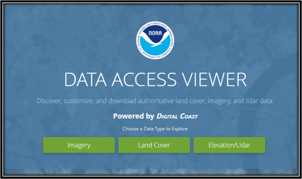
The Data Access Viewer (DAV) allows a user to search for and download elevation (lidar), imagery, and land cover data for the coastal U.S. and its territories. The data, hosted by the NOAA Office for Coastal Management, can be customized and requested for free download through a checkout interface. An email provides a link to the customized data, while the original data set is available through a link within the viewer.
Environmental maps
Wetland and Wetland Change Areas
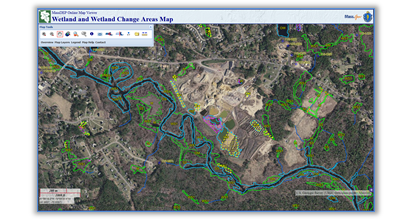
The Wetland and Wetland Change Areas Map displays MassDEP developed wetland areas interpreted from 1:12,000 scale, stereo color-infrared (CIR) photography captured in 1990, 1991, 1992, 1993, 1999 and 2000. The map also includes Wetland Change areas interpreted from three separate iterations of MassGIS orthophotography.
The wetland and wetland change areas represented on this map have been determined solely through photo-interpretation. They do not represent, and should not be used as, wetlands delineation under the Wetlands Protection Act (M.G.L. c. 131, sec. 40) and the implementing regulations (310 CMR 10.00 et seq.).
The Wetland and Wetland Change Areas Map is scale sensitive and will only draw when the map viewer is zoomed in to an appropriate, large scale. At smaller scales only the underlying base map will be displayed.
>> Open the MassDEP Wetland map
DCR Areas of Critical Environmental Concern (ACECs)
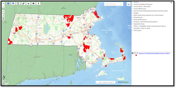
This map can be used to display and find information on Areas of Critical Environmental Concern. Developed by the Department of Conservation and Recreation. ACECs are places in Massachusetts that receive special recognition because of the quality, uniqueness and significance of their natural and cultural resources.
DCR-DWSP Watershed Protection Act Viewer
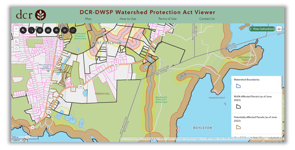
This viewer can be used to find information on how the Watershed Protection Act (WsPA) affects parcels in the Quabbin Reservoir, Ware River, and Wachusett Reservoir watersheds. The Watershed Protection Act regulates land use activities within critical areas of the source drinking water supply for over 3 million people.
>> Open the DCR Watershed Protection Act Viewer
EEA Environmental Justice
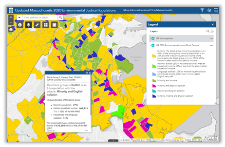
Displays neighborhoods across the state with high minority, non-English speaking and low-income populations (based on 2020 U.S. Census data). Such areas are the focus of EOEEA's EJ Policy, which was developed to use state resources to ensure that EJ populations receive a strong voice in environmental decision-making.
>> Open the EEA Environmental Justice map
DEP Water Quality Data Viewer
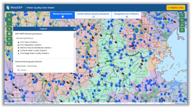
The MassDEP Water Quality Data Viewer provides access to water quality information generated by the Watershed Planning Program for surface waters throughout the Commonwealth, including Surface Water Quality Standards classifications and information on current/historic water quality assessments and impaired waters listings. This viewer, developed using EPA Exchange Network grant funds, enables sharing of data related to implementation of the Clean Water Act, such as protection and restoration of rivers, lakes, wetlands and estuaries. The viewer will be updated periodically as newer data become available.
>>Open the MassGIS Water Quality Viewer
Massachusetts Geothermal Data Viewer
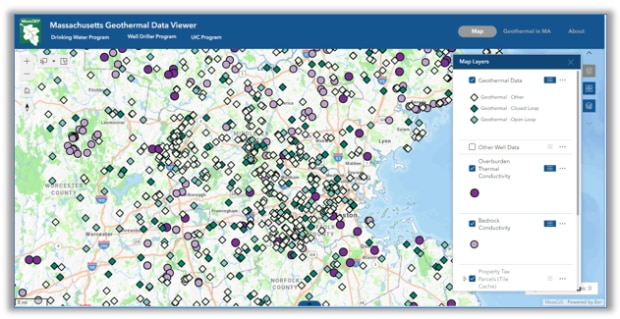
The Massachusetts Geothermal Data Viewer is an interactive web map collecting and summarizing a variety of publicly available geothermal data for the benefit of drillers, scientists, and the general public. Open and closed-loop geothermal well logs derive from MassDEP's collection of 207,000+ Well Completion Reports. Well Completion Report Source. Well locations are approximate. Wells depicted as being located on top of a structure may not physically be on or within that structure, but rather somewhere within the given parcel.
>>Open the Massachusetts Geothermal Viewer
BioMap: The Future of Conservation in Massachusetts
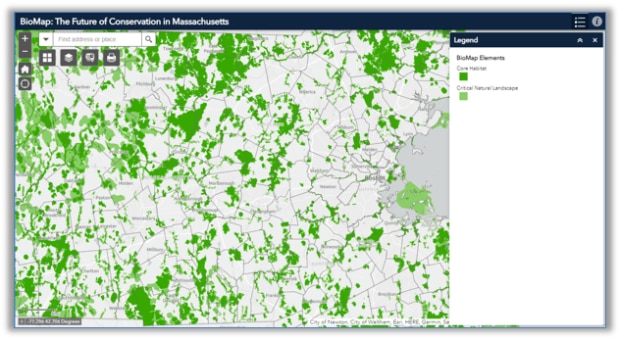
The BioMap: The Future of Conservation in Massachusetts map displays the two primary BioMap elements, Core Habitat and Critical Natural Landscape areas. BioMap is the result of an ongoing collaboration between MassWildlife and the Massachusetts Chapter of The Nature Conservancy (TNC). It is a framework for the strategic protection and stewardship of lands and waters that are most important for conserving our state’s rich natural heritage and ensuring a climate-resilient landscape, now, and for future generations.
Species and habitat maps
NHESP Priority and Estimated Habitats
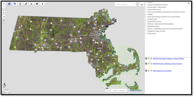
Displays the most current regulatory layers developed by the Natural Heritage and Endangered Species Program - Priority Habitats and Estimated Habitats. The Priority and Estimated Habitats presented here are part of the 14th Edition of the Massachusetts Natural Heritage Atlas, and are effective beginning August 1, 2017.
>> Open the NHESP Priority and Estimated Habitats map
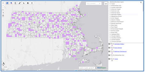
MassAudubon Butterfly Atlas
The MassAudubon Butterfly Atlas Viewer allows you to interactively create your own maps of all or a portion of the state, identify all species found in a survey block during the Atlas period, and overlay butterfly distribution on road, land use and aerial photograph backgrounds.
>> Open the MassAudubon Butterfly Atlas
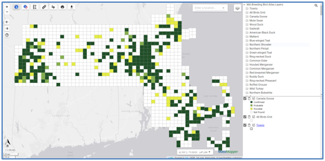
MassAudubon Breeding Bird Atlas
The MassAudubon Breeding Bird Atlas Viewer allows you to interactively create your own maps of all or a portion of the state, identify all species found in a survey block during the Atlas period, and overlay bird distribution with roads and topographic backgrounds.
>> Open the MassAudubon Breeding Bird Atlas
Trout Stocked Waters
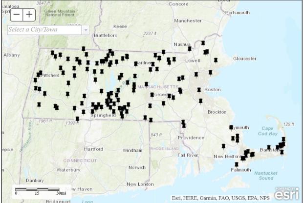
MassWildlife regularly stocks lakes and ponds with Trout. To see what waters were most recently stocked, use this map. In the Fall of 2018, 60,000 rainbow trout that are 12 inches or longer and 4,000 brown trout about 12 inches long were stocked across Massachusetts.
Infrastructure, districts and demographics
MassUtilities
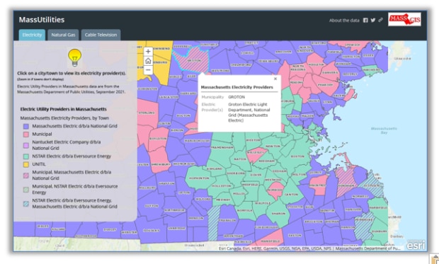
This three-tab mapping application displays the the public Electric, Natural Gas, and Cable Television utility providers for each Massachusetts municipality. Data from the Mass. Dept. of Public Utilities (Sept. 2021) and the Mass. Dept. of Telecommunications and Cable (Nov. 2019).
Legislative District Browser
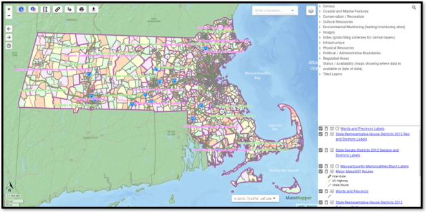
Displays the Commonwealth's Senate and House legislative districts. You can search for their district based on municipality, legislator, or district name. When you click on a district, the results pop-up window contain links to the senator's and representative's Web pages.
>> Open the Legislative Districts map
DCR Dams
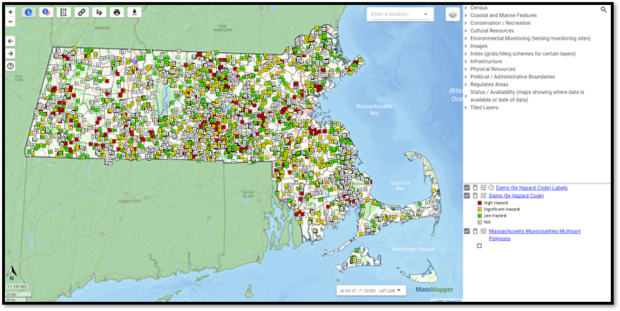
Displays dams with the option of zooming to dam ID or filtering list of dams by town. You can then pick the name of dam and zoom directly to that location. Data are provided by the Department of Conservation and Recreation.
DPH Climate Change Vulnerable Populations Map
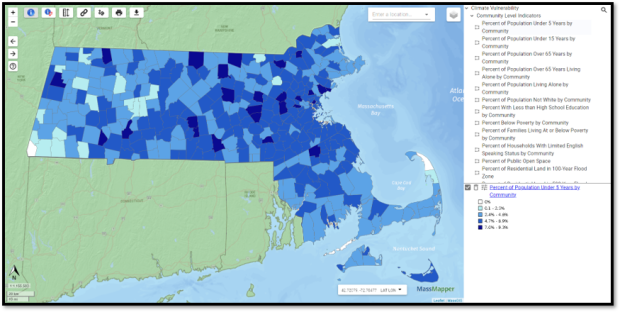
The American Community Survey (ACS) 5-year (2011-2015) estimates were used for the demographic data presented in the vulnerability mapping tool. Several environmental map layers are also presented in this online mapping tool.
>> Open the DPH Climate Change Vulnerable Populations map
MassDOT Road Inventory Map
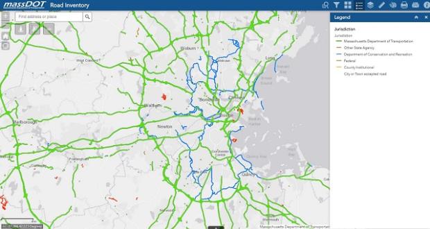
This map shows the most commonly requested Road Inventory attributes, Functional Classification, Jurisdiction, National Highway System, Federal Functional classification, and Federal-Aid Eligibility using the most current year-end file.
>> Open the MassDOT Road Inventory map
MassDOT Top Crash Locations
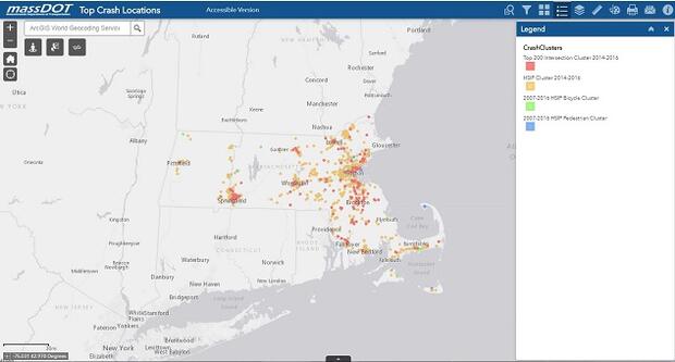
The 'Top High Crash Intersection Locations' are based on a clustering of crashes that have been submitted to the statewide crash system at the Registry of Motor Vehicles and located to a geographical point.
>> Open the MassDOT Top Crash Locations map
Statewide Address Points
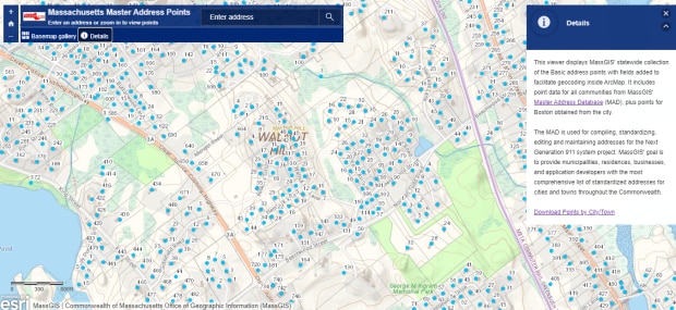
This map is refreshed weekly as MassGIS staff work to pinpoint every address in the state as part of our work for the State911 Department.
Tourism and recreation
Find a DCR Park
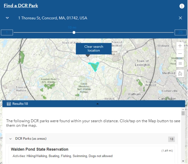
The Massachusetts state parks system, managed by the Department of Conservation and Recreation, features locations for all kinds of outdoor enthusiasts. Whether you're looking to camp under the stars, hike a mountain, or fish for trout, there's something for you. Here, you can learn about DCR beaches, wooded parks, reservations, reservoirs, and more.
>> Download Park Trail Maps as PDFs
Craft Breweries, Cideries, Distilleries and Wineries
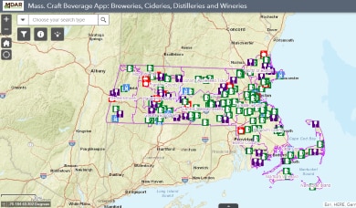
Search over 180 craft beverage businesses with tasting rooms across the state. Created by the Department of Agricultural Resources, the map displays craft beverage businesses with tasting rooms open to the public.
>> Open the Craft Beverages map
MassGrown Farm Finder
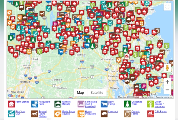
Agri-Tourism has become a popular pastime. this map is your gateway to 100's of farms that offer pick-your-own, farmstands, flower and nursery greenhouses, and agri-tourism.