Downloads
Zip file with polygon and line shapefiles
Overview
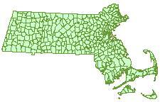
This layer was produced by MassGIS for display purposes when mapping any of the other Census 2000 layers. The town boundary and coastline features developed by the Census Bureau do not match those in MassGIS' own Municipalities layer, and these spatial discrepancies become more apparent at larger scales. MassGIS recommends the use of this layer when plotting municipal boundaries with the other Census 2000 layers. Two shapefiles are available, one for polygons and one for arcs.
Production
The polygon layer was produced by dissolving the Census 2000 Blocks layer (without offshore zero-population polygons) on the TOWN_ID field. Population fields were added by joining to the polygon attribute table in the MassGIS Municipalities layer. The Arc layer was generated from the polygon layer using XTools for ArcMap 8.1 Version 3.0. The resulting polylines were converted to an ArcInfo coverage and the lines were coded for coastline, municipal boundaries, and state outline. The coverage was then converted to a shapefile..
Attributes
The polygon attributes (census2000towns_poly.dbf) for the Census 2000 Towns shapefiles distributed by MassGIS contain the following items:
| ITEM NAME | TYPE / WIDTH | DESCRIPTION |
|---|---|---|
| TOWN_ID | N / 4 | MassGIS Town ID |
| TOWN | C / 21 | Town Name |
| POP1980 | N / 6 | 1980 Population |
| POP1990 | N / 6 | 1990 Population |
| POP2000 | N / 6 | 2000 Population |
| POPCH80_90 | N / 5 | Population Change, 1980-1990 |
| POPCH90_00 | N / 5 | Population Change, 1990-2000 |
| AREA | F / 19 | Area of polygon(s) in square meters |
| PERIMETER | F / 19 | Perimeter of polygon(s) in meters |
| ACRES | F / 19 | Area of polygon(s) in acres |
| SQ_MI | N / 11 | Area of polygon(s) in square miles |
The Area, Perimeter, and Acres fields were calculated by XTools for ArcMap 8.1 Version 3.0. The Sq_Mi field was calculated by multiplying the Acres field by 0.0015625.
The arc attributes (census2000towns_arc.dbf) contains an item added called OUTLINE, which enables differentiation of line type (e.g. dashed lines inside the state and solid for the outside). OUTLINE codes are:
- 1 = Interstate boundaries
- 17 = Internal boundaries
- 4 = Coastline
Maintenance
MassGIS is maintaining this layer. Minor updates to the geometry of both the polygon and arc feature classes were made in May 2003.